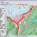
TNTmips 20240404 freeware

TNTmips is a geospatial image processing tool that allows you to analyze and modify GIS images. It is a professional application that can handle desktop cartography, electronic atlas preparation and spatial database management. ...

Author MicroImages, Inc.
Released 2024-04-04
Filesize 121.00 MB
Downloads 1646
OS Windows XP, Windows Vista, Windows Vista x64, Windows 7, Windows 7 x64, Windows 8, Windows 8 x64, Windows 10, Windows 10 x64, Windows 11
Installation Instal And Uninstall
Keywords GIS data analysis, analyze geodetic data, edit GIS dataset, GIS, dataset, editor, analysis
Users' rating
(116 rating)
TNTmipsCADWindows XP, Windows Vista, Windows Vista x64, Windows 7, Windows 7 x64, Windows 8, Windows 8 x64, Windows 10, Windows 10 x64, Windows 11
TNTmips - file system Freeware Download Notice

TNTmips Free Download - we do not host any TNTmips torrent files or links of TNTmips on rapidshare.com, depositfiles.com, megaupload.com etc. All TNTmips download links are direct TNTmips download from publisher site or their selected mirrors.

TNTmips freeware - The Latest User Reviews
TNTmips freeware - The Latest Versions History
20240404 Apr 4, 2024 New Release
20240131 Jan 31, 2024 New Release
20240108 Jan 8, 2024 New Release

Most popular CAD freeware downloads

FilterPro Desktop

3.1.0.23446 freeware download

... filters now accounts for passband ripple Supports design file migration from FilterPro v2 so that designs created ... all-pass phase shift/time delay filters to help ease system design. ...

TinyCAD

3.00.04 freeware download

... bitmap. TinyCAD supports outputing ciruits diagrams as PNG files. If you are not familar with PNG files, they are the open-source equivilent of GIFs. All modern web browsers and operating systems support PNG files. You can create PNG ...

QGIS for Mac

3.36.1 freeware download

... formats support by the OGR library · MapInfo files · GRASS integration, including view, edit, and analysis ... and multiband RGB) · Export to Mapserver map file · Digitizing support · Map overview · Plugins ...

SDMetrics

2.5 freeware download

... identify potential design problems early on predict relevant system qualities such as fault-proneness or maintainability to better focus your review and testing efforts increase system quality and quality assurance effectiveness, find more faults ...

QGIS for Linux

3.36.1 freeware download

... formats support by the OGR library · MapInfo files · GRASS integration, including view, edit, and analysis ... and multiband RGB) · Export to Mapserver map file · Digitizing support · Map overview · Plugins ...

Jmol

14.31.53 freeware download

... Jmol's features include reading a variety of file types and output from quantum chemistry programs, and animation of multi-frame files and computed normal modes from quantum programs. ...

Jmol for Linux

14.31.53 freeware download

... Jmol's features include reading a variety of file types and output from quantum chemistry programs, and animation of multi-frame files and computed normal modes from quantum programs. ...

Open3DALIGN x64

2.28 freeware download

... standard input. If PyMOL is installed on the system while Open3DALIGN is being operated interactively, the setup ... 1. A dataset is imported as SDF file 2. Optionally, for each compound of the dataset ...

Open3DALIGN for Mac OS X

2.28 freeware download

... standard input. If PyMOL is installed on the system while Open3DALIGN is being operated interactively, the setup ... 1. A dataset is imported as SDF file 2. Optionally, for each compound of the dataset ...

Gnuplot for Windows

5.2.7 freeware download

... interactive screen display: cross-platform (Qt, wxWidgets, x11) or system-specific (MS Windows, OS/2) static screen display: system-specific (OSX(aqua), svga, ...) direct output to file: postscript (including eps), pdf, png, gif, jpeg, LaTeX, ...