GetNexrad 4.4.2 freeware

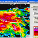
... rainfall loops and to generate the basin point file (NexradPointESX10210.txt) used by GetRealtime.exe for computing the basin area average rainfall time series in real time. ...

Author Carson
Released 2023-08-08
Filesize 10.00 MB
Downloads 553
OS Windows XP, Windows Vista, Windows Vista x64, Windows 7, Windows 7 x64, Windows 8, Windows 8 x64, Windows 10, Windows 10 x64, Windows 11
Installation Instal And Uninstall
Keywords extract rainfall amount, DBZ analysis, view radar rainfall, view, extract, rainfall
Users' rating
(14 rating)
GetNexradCADWindows XP, Windows Vista, Windows Vista x64, Windows 7, Windows 7 x64, Windows 8, Windows 8 x64, Windows 10, Windows 10 x64, Windows 11
GetNexrad - file Freeware Download Notice

GetNexrad Free Download - we do not host any GetNexrad torrent files or links of GetNexrad on rapidshare.com, depositfiles.com, megaupload.com etc. All GetNexrad download links are direct GetNexrad download from publisher site or their selected mirrors.

GetNexrad freeware - The Latest User Reviews
GetNexrad freeware - The Latest Versions History
4.4.2 Aug 8, 2023 New Release
4.3.3 Feb 19, 2019 New Release
4.1.5 Mar 8, 2017 New Release

Most popular CAD freeware downloads

Gephi

0.10.1 freeware download

... component. · Import temporal graph with the GEXF file format · Graph streaming ready Create cartography: ... in workspaces and save their session .gephi project files. · Save/Load project files · Use the Data ...

FilterPro Desktop

3.1.0.23446 freeware download

... filters now accounts for passband ripple Supports design file migration from FilterPro v2 so that designs created in the prior version can benefit from the ...

enCIFer for Mac OS X

1.4 freeware download

The Crystallographic Information File (CIF) is the internationally agreed standard file format for information exchange in crystallography. The CIF ... enables users to validate CIFs and ensure their files are format-compliant for deposition with journals and databases ...

TinyCAD

3.00.04 freeware download

... bitmap. TinyCAD supports outputing ciruits diagrams as PNG files. If you are not familar with PNG files, they are the open-source equivilent of GIFs. All modern web browsers and operating systems support PNG files. You can create PNG files directly from ...

TNTatlas

2024 B20240606 freeware download

... and geospatial data — from a single geodata file to complex map layouts prepared using TNTmips. TNTatlas ... massive sized geodata and will directly display numerous file formats including shapefiles, GeoTIFF, JP2, PNG, MrSID, DXF, ...

PotterDraw

1.0.02.000 freeware download

... palette using various patterns, or a user-specified image file can be texture-mapped via trigonometric functions. Export 3D models as color PLY file, monochrome STL file, or Wavefront OBJ file. PLY ...

QGIS for Mac

3.36.1 freeware download

... formats support by the OGR library · MapInfo files · GRASS integration, including view, edit, and analysis ... and multiband RGB) · Export to Mapserver map file · Digitizing support · Map overview · Plugins ...

Gmsh

4.13.1 freeware download

... translate, rotate, scale), physical groups (coherence, reload, edit file), define one, two and three dimensions, as well ... the graphical user interface or in ASCII text files using Gmsh's own scripting language. The tool does ...

Toxtree

3.1.0 freeware download

... could be applied to datasets from various compatible file types. User-defined molecular structures are also supported - they could be entered by SMILES, or by ...

QGIS for Linux

3.36.1 freeware download

... formats support by the OGR library · MapInfo files · GRASS integration, including view, edit, and analysis ... and multiband RGB) · Export to Mapserver map file · Digitizing support · Map overview · Plugins ...