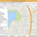
QGIS 3.36.1 freeware

QGIS supports vector, raster, and database formats and lets you browse and create map data on your computer.
QGIS supports many common spatial data formats (e.g. ESRI ShapeFile, geotiff). QGIS supports plugins to do things like display tracks from your GPS.
QGIS aims to be an easy to use GIS, providing common functions and features. The initial goal was to provide a GIS data viewer. ...

Author Gary Sherman
Released 2024-03-26
Filesize 1000.00 MB
Downloads 836
OS Windows XP, Windows Vista, Windows Vista x64, Windows 7, Windows 7 x64, Windows 8, Windows 8 x64, Windows 10, Windows 10 x64, Windows 11
Installation Instal And Uninstall
Keywords geographic information system, map creator, map viewer, GIS, geographic information, create, QGIS
Users' rating
(38 rating)
QGISCADWindows XP, Windows Vista, Windows Vista x64, Windows 7, Windows 7 x64, Windows 8, Windows 8 x64, Windows 10, Windows 10 x64, Windows 11
QGIS - file Freeware Download Notice

QGIS Free Download - we do not host any QGIS torrent files or links of QGIS on rapidshare.com, depositfiles.com, megaupload.com etc. All QGIS download links are direct QGIS download from publisher site or their selected mirrors.

QGIS freeware - The Latest User Reviews
QGIS freeware - The Latest Versions History
3.36.1 Mar 26, 2024 New Release
3.36.2 Apr 25, 2024 New Release
3.36.1 Mar 26, 2024 New Release

Most popular CAD freeware downloads

DSI Studio

.59 freeware download

... of passing and/or regions of avoidace. · Supported file format for input ROI: text file, Analyze, NIFTI · Supported file format for output tracts: text file, TrackVis .trk ...

FilterPro Desktop

3.1.0.23446 freeware download

... filters now accounts for passband ripple Supports design file migration from FilterPro v2 so that designs created in the prior version can benefit from the ...

QGIS for Mac

3.36.1 freeware download

... formats support by the OGR library · MapInfo files · GRASS integration, including view, edit, and analysis ... and multiband RGB) · Export to Mapserver map file · Digitizing support · Map overview · Plugins ...

TinyCAD

3.00.04 freeware download

... bitmap. TinyCAD supports outputing ciruits diagrams as PNG files. If you are not familar with PNG files, they are the open-source equivilent of GIFs. All modern web browsers and operating systems support PNG files. You can create PNG files directly from ...

Online CAD Converter

1.5 freeware download

... safest solution to convert CAD, CGM, HPGL, SVG files. Output file types include PDF, TIFF, JPEG, EMF, CGM, HPGL, ... fast and user-friendly. You browse for your CAD file and then wait for the resulting document in ...

Mobile Atlas Creator for Mac OS X

2.2.1 freeware download

... as one large PNG image with calibration MAP file for OziExplorer. As source for an offline atlas ... Trail Explorer (J2ME) - single tiles and MTECache file NaviComputer (Windows Mobile) nfComPass (WinCE, WinMobile, WinXP) OruxMaps ...

OpenDCL Studio

9.1.5.2 freeware download

OpenDCL is a handy, easy-to-use and accessible insturment that is specially designed for AutoLISP programmers that want to replace AutoCAD's limited DCL. They can replace ...

Doodles 3D

0.76 freeware download

... You can save the points to a text file that can be easily modified with a basic text editor. ...

GstarCAD MC

3.3.1 freeware download

... edit CAD drawings ( DWG, OCF and DXF files) directly on your mobile device after transferring them. ... There is no limit to how large the file is. • Fully compatibility with AutoCAD. (2) No ...

TNTatlas

2024 B20240606 freeware download

... and geospatial data — from a single geodata file to complex map layouts prepared using TNTmips. TNTatlas ... massive sized geodata and will directly display numerous file formats including shapefiles, GeoTIFF, JP2, PNG, MrSID, DXF, ...