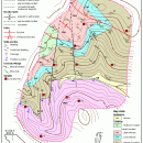
TNTatlas for Mac OS X 2023 B20230323 freeware

... and geospatial data — from a single geodata file to complex map layouts prepared using TNTmips. TNTatlas ... massive sized geodata and will directly display numerous file formats including shapefiles, GeoTIFF, JP2, PNG, MrSID, DXF, and DWG. ...

Author MicroImages, Inc.
Released 2023-03-23
Filesize 87.90 MB
Downloads 724
OS Mac OS X
Installation Instal And Uninstall
Keywords geospatial viewer, view atlas, visualize geospatial data, atlas, map, viewer
Users' rating
(42 rating)
TNTatlas for Mac OS XCADMac OS X
TNTatlas for Mac OS X - file Freeware Download Notice

TNTatlas for Mac OS X Free Download - we do not host any TNTatlas for Mac OS X torrent files or links of TNTatlas for Mac OS X on rapidshare.com, depositfiles.com, megaupload.com etc. All TNTatlas for Mac OS X download links are direct TNTatlas for Mac OS X download from publisher site or their selected mirrors.

TNTatlas for Mac OS X freeware - The Latest User Reviews
TNTatlas for Mac OS X freeware - The Latest Versions History
2023 B202303 Mar 23, 2023 New Release
2022 B202212 Dec 7, 2022 New Release
2022 B202211 Nov 30, 2022 New Release

Most popular CAD freeware downloads

SearchGUI

4.3.9 freeware download

... DirecTag. To start using SearchGUI, unzip the downloaded file, and double-click the SearchGUI-X.Y.Z.jar file. No additional installation required! The main purpose of ...

New Version

TNTmips for Mac OS X

20240111 freeware download

... an unsurpassed number of raster, geometric, and database file formats; convert between data types; and link to ... formats including GeoTIFF, JPEG2000, PNG, MrSID, ECW, shapefile, File Geodatabase, Oracle Spatial, DGN, TAB, DXF, DWG. ...

FilterPro Desktop

3.1.0.23446 freeware download

... filters now accounts for passband ripple Supports design file migration from FilterPro v2 so that designs created in the prior version can benefit from the ...

QGIS for Mac

3.36.1 freeware download

... formats support by the OGR library · MapInfo files · GRASS integration, including view, edit, and analysis ... and multiband RGB) · Export to Mapserver map file · Digitizing support · Map overview · Plugins ...

QGIS for Linux

3.36.1 freeware download

... formats support by the OGR library · MapInfo files · GRASS integration, including view, edit, and analysis ... and multiband RGB) · Export to Mapserver map file · Digitizing support · Map overview · Plugins ...

TNTmips

20240404 freeware download

... an unsurpassed number of raster, geometric, and database file formats; convert between data types; and link to ... formats including GeoTIFF, JPEG2000, PNG, MrSID, ECW, shapefile, File Geodatabase, Oracle Spatial, DGN, TAB, DXF, DWG ... ...

QGIS

3.36.1 freeware download

... formats support by the OGR library · MapInfo files · GRASS integration, including view, edit, and analysis ... and multiband RGB) · Export to Mapserver map file · Digitizing support · Map overview · Plugins ...

Panoply

5.3.4 freeware download

... or slice geo-gridded and other types of arrays. Files can be imported in the working environment using ... KMZ, GIF, PDF, PNG, PS, AVI or MOV file format. In addition, you may save data to ...

Sweet Home 3D

7.3 freeware download

... bitmap or vector graphics images, videos and 3D files in standard file formats. Extend the features of Sweet Home ...

VariCAD Viewer for Linux

2024 1.05 freeware download

... 2D DWG, DXF, 3D STEP and 2D/3D VariCAD file formats. VariCAD viewer allows you to convert DWG ... display can be also exported into high-resolution bitmap file. ...