Engauge Digitizer for Linux 12.0 freeware

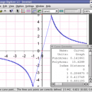
... This open source, digitizing software converts an image file showing a graph or map, into numbers. The image file can come from a scanner, digital camera or ...
The process starts with an image file containing a graph or map. The final result is digitized data that can be used by other tools such as Microsoft Excel. ...

Author Mark Mitchell
Released 2019-08-19
Filesize 10.00 MB
Downloads 839
OS Linux
Installation Instal And Uninstall
Keywords digitize image, image to number, process image, digitize, convert, digitizer
Users' rating
(45 rating)
Engauge Digitizer for LinuxCADLinux
Engauge Digitizer for Linux - file time Freeware Download Notice

Engauge Digitizer for Linux Free Download - we do not host any Engauge Digitizer for Linux torrent files or links of Engauge Digitizer for Linux on rapidshare.com, depositfiles.com, megaupload.com etc. All Engauge Digitizer for Linux download links are direct Engauge Digitizer for Linux download from publisher site or their selected mirrors.

Engauge Digitizer for Linux freeware - The Latest User Reviews
Engauge Digitizer for Linux freeware - The Latest Versions History
12.0 Aug 19, 2019 New Release New hourglass and triangle point types (#346)
Fix data export for log scale data when step factor is less than one (#345)
10.4 Oct 11, 2017 New Release Show warning message when grid line maximum is exceed (#244)
CSV export files have double quotes on fields with internal commas (#243)
Status bar shows all of text for right-to-left languages (#240)
5.1 Dec 24, 2012 New Release Fix for broken point matching, and control of the x/theta axis label.

Most popular CAD freeware downloads

FilterPro Desktop

3.1.0.23446 freeware download

... filters now accounts for passband ripple Supports design file migration from FilterPro v2 so that designs created ... of v3.1. Easily generate schematics, view frequency and time responses, and print professional design reports containing all ...

MyCadbox

1.0.0.0 freeware download

MyCadbox highlights: * Open large STEP and IGES files ultra-fast on PC and iPad * Share STEP and IGES files easily with your team * Sync files and ...

MITO

2.0 freeware download

The "MITO - Medical Imaging TOolkit" project coagulates a number of activities aimed at defining and implementing an open-source, cross-platform software architecture for advanced Medical Imaging. ...

X-Sweet Home 3D

4.4 [rev18] freeware download

... lights and control sunlight effect according to the time of day and geographic location · Import home ... bitmap or vector graphics images, videos and 3D files in standard file formats · Extend the features ...

eMachineShop 3D CAD

1.52 freeware download

... the fly - and prices are updated every time you start the program via and auto-updating price file. This means designers can do near-real-time design optimization. ...

VEGA ZZ

3.2.3.28 freeware download

... animation). 3D interactive monitors calculated in real time (distance, angle, torsion and angle between two planes). ... and animation with full support for Accelrys archive file (.arc), AutoDock 4 DLG, BioDock output, CSR (Accelrys ...

Engauge Digitizer for Linux

12.0 freeware download

... This open source, digitizing software converts an image file showing a graph or map, into numbers. The image file can come from a scanner, digital camera or ...

PreviSat

6.1.0.3 freeware download

... observe the position of artificial satellites in real time. The tool is able to offer predictions about ... observing the displacement of the satellites in real time or manually setting the time for displaying satellite ...

Engauge Digitizer for Mac OS X

12.0 freeware download

... This open source, digitizing software converts an image file showing a graph or map, into numbers. The image file can come from a scanner, digital camera or ...

5 freeware award

TNTatlas for Mac OS X

2024 B20240508 freeware download

... and geospatial data — from a single geodata file to complex map layouts prepared using TNTmips. TNTatlas ... massive sized geodata and will directly display numerous file formats including shapefiles, GeoTIFF, JP2, PNG, MrSID, DXF, ...