Gephi 0.10.1 freeware

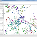
Gephi is a tool for people that have to explore and understand graphs. Like Photoshop but for data, the user interacts with the representation, manipulate the structures, shapes and colors to reveal hidden properties. The goal is to help data analysts to make hypothesis, intuitively discover patterns, isolate structure singularities or faults during data sourcing. ...

Author Mathieu Bastian
Released 2023-01-17
Filesize 120.00 MB
Downloads 1077
OS Windows XP, Windows Vista, Windows Vista x64, Windows 7, Windows 7 x64, Windows 8, Windows 8 x64, Windows 10, Windows 10 x64, Windows 11
Installation Instal And Uninstall
Keywords interactive visualization, exploration platform, visualization platform, visualization, exploration, graph
Users' rating
(35 rating)
GephiCADWindows XP, Windows Vista, Windows Vista x64, Windows 7, Windows 7 x64, Windows 8, Windows 8 x64, Windows 10, Windows 10 x64, Windows 11
Gephi - file tools Freeware Download Notice

Gephi Free Download - we do not host any Gephi torrent files or links of Gephi on rapidshare.com, depositfiles.com, megaupload.com etc. All Gephi download links are direct Gephi download from publisher site or their selected mirrors.

Gephi freeware - The Latest User Reviews
Gephi freeware - The Latest Versions History
0.10.1 Jan 17, 2023 New Release Bugfixes:
Problem when saving (0.10.0)
Infinite loop when opening project
0.9.2 Sep 26, 2017 New Release New features highlight:
New CSV/Spreadsheet importer migrated to Import API. More user friendly, autodetects imported columns types and data format. Integrated with the rest of file importer formats through import report. Now supports importing excel files.
0.9.1 Jan 25, 2016 New Release New German localization

Most popular CAD freeware downloads

Gmsh

4.13.1 freeware download

... mesh. It comes packed with a few handy tools for advanced users. Gmsh is a CAD ... translate, rotate, scale), physical groups (coherence, reload, edit file), define one, two and three dimensions, as well ...

QGIS for Linux

3.36.1 freeware download

... formats support by the OGR library · MapInfo files · GRASS integration, including view, edit, and analysis ... and multiband RGB) · Export to Mapserver map file · Digitizing support · Map overview · Plugins ...

Gephi

0.10.1 freeware download

... Iterate through visualization using dynamic filtering · Rich tools for meaningful graph manipulation Layout: · Layout ... component. · Import temporal graph with the GEXF file format · Graph streaming ready Create cartography: ...

Engauge Digitizer for Mac OS X

12.0 freeware download

... This open source, digitizing software converts an image file showing a graph or map, into numbers. The image file can come from a scanner, digital camera or ...

5 freeware award

Engauge Digitizer for Linux

12.0 freeware download

... This open source, digitizing software converts an image file showing a graph or map, into numbers. The image file can come from a scanner, digital camera or ...

GOM Inspect

7.5 SR1 freeware download

... Point Cloud Import 3D Mesh Processing 3D Inspection Tools 2D Analysis Comprehensive Reporting Data Export Extensive, certified inspection tools GOM Inspect contains all evaluation tools for ...

Model Air Design

2.4 freeware download

... users create 3D-model aircrafts. While other dedicated CAD tools come packed with many editing capabilities and parameters ... model plans. However, it can export a model file that can be used by most CAD programs. ...

Picard

2.27.2 freeware download

Picard comprises Java-based command-line utilities that manipulate SAM files, and a Java API (SAM-JDK) for creating new programs that read and write SAM files. Both SAM text format and SAM binary (BAM) ...

QGIS

3.36.1 freeware download

... formats support by the OGR library · MapInfo files · GRASS integration, including view, edit, and analysis ... and multiband RGB) · Export to Mapserver map file · Digitizing support · Map overview · Plugins ...

QGIS for Mac

3.36.1 freeware download

... formats support by the OGR library · MapInfo files · GRASS integration, including view, edit, and analysis ... and multiband RGB) · Export to Mapserver map file · Digitizing support · Map overview · Plugins ...