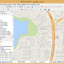
QGIS 3.36.1 freeware

QGIS supports vector, raster, and database formats and lets you browse and create map data on your computer.
QGIS supports many common spatial data formats (e.g. ESRI ShapeFile, geotiff). QGIS supports plugins to do things like display tracks from your GPS.
QGIS aims to be an easy to use GIS, providing common functions and features. The initial goal was to provide a GIS data viewer. ...

Author Gary Sherman
Released 2024-03-26
Filesize 1000.00 MB
Downloads 839
OS Windows XP, Windows Vista, Windows Vista x64, Windows 7, Windows 7 x64, Windows 8, Windows 8 x64, Windows 10, Windows 10 x64, Windows 11
Installation Instal And Uninstall
Keywords geographic information system, map creator, map viewer, GIS, geographic information, create, QGIS
Users' rating
(38 rating)
QGISCADWindows XP, Windows Vista, Windows Vista x64, Windows 7, Windows 7 x64, Windows 8, Windows 8 x64, Windows 10, Windows 10 x64, Windows 11
QGIS - file tools Freeware Download Notice

QGIS Free Download - we do not host any QGIS torrent files or links of QGIS on rapidshare.com, depositfiles.com, megaupload.com etc. All QGIS download links are direct QGIS download from publisher site or their selected mirrors.

QGIS freeware - The Latest User Reviews
QGIS freeware - The Latest Versions History
3.36.1 Mar 26, 2024 New Release
3.36.2 Apr 25, 2024 New Release
3.36.1 Mar 26, 2024 New Release

Most popular CAD freeware downloads

Gmsh

4.13.1 freeware download

... mesh. It comes packed with a few handy tools for advanced users. Gmsh is a CAD ... translate, rotate, scale), physical groups (coherence, reload, edit file), define one, two and three dimensions, as well ...

Engauge Digitizer for Linux

12.0 freeware download

... This open source, digitizing software converts an image file showing a graph or map, into numbers. The image file can come from a scanner, digital camera or ...

Portable MicroDicom

2024.2 freeware download

... DICOM format. It is equipped with most common tools for manipulation of DICOM images and it has ... *.bmp, *.gif, etc) Open and save DICOM directory files Display of patient list from DICOMDIR Display images ...

PyPedal

2.0.3 freeware download

... provide instruments for the manipulation of pedigrees. The tools provided can also offer simple visualization of pedigrees ... diversity from pedigrees. Features Reading pedigree files in user-defined formats Checking pedigree integrity (duplicate IDs, ...

QGIS for Mac

3.36.1 freeware download

... formats support by the OGR library · MapInfo files · GRASS integration, including view, edit, and analysis ... and multiband RGB) · Export to Mapserver map file · Digitizing support · Map overview · Plugins ...

TNTmips for Mac OS X

20240111 freeware download

... with associated database attributes. It provides all the tools you need to view, create, edit, georeference, interpret, ... type of geospatial data. TNTmips provides professional geospatial tools in a single package at an affordable price ...

Gephi for Linux

0.10.1 freeware download

... Iterate through visualization using dynamic filtering · Rich tools for meaningful graph manipulation Layout: · Layout ... component. · Import temporal graph with the GEXF file format · Graph streaming ready Create cartography: ...

Gephi for Mac OS X

0.10.1 freeware download

... Iterate through visualization using dynamic filtering · Rich tools for meaningful graph manipulation Layout: · Layout ... component. · Import temporal graph with the GEXF file format · Graph streaming ready Create cartography: ...

MicroDicom

2024.2 freeware download

... DICOM format. It is equipped with most common tools for manipulation of DICOM images and it has ... *.bmp, *.gif, etc) Open and save DICOM directory files Display of patient list from DICOMDIR Display images ...

nanoCAD

5.1.2524.2017 freeware download

... .dwg support. Being the ultimate in 2D design tools, nanoCAD has been built to deliver design and ... - Native *.dwg support. The world's most popular file format for technical documentation - *.dwg - is ...