Geogiga Front End 9.0 freeware

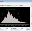
... preprocess single shot record. You can convert data formats, analyze amplitude decay, correct trigger delay, assign geometry, mute seismic traces, run frequency filter, gain control, vertical stacking, and such. ...

Author Geogiga Technology Corp.
Released 2019-10-02
Filesize 6.02 MB
Downloads 620
OS Windows XP, Windows Vista, Windows Vista x64, Windows 7, Windows 7 x64
Installation Instal And Uninstall
Keywords preprocess seismic data, analyze amplitude decay, correct trigger delay, viewer, editor, correct
Users' rating
(21 rating)
Geogiga Front EndCADWindows XP, Windows Vista, Windows Vista x64, Windows 7, Windows 7 x64
Geogiga Front End - formats file Freeware Download Notice

Geogiga Front End Free Download - we do not host any Geogiga Front End torrent files or links of Geogiga Front End on rapidshare.com, depositfiles.com, megaupload.com etc. All Geogiga Front End download links are direct Geogiga Front End download from publisher site or their selected mirrors.

Geogiga Front End freeware - The Latest User Reviews
Geogiga Front End freeware - The Latest Versions History
9.0 Oct 2, 2019 New Release
8.0 Aug 20, 2015 New Release
7.1 Oct 25, 2012 New Release · Fixed the bugs in reading SEG-D and SEG-Y.

Most popular CAD freeware downloads

Mini CAD Viewer

3.7.0.0 freeware download

... on task folders. It supports DWG, DWF, DXF formats. It allows drawing file to be printed. ...

MicroDicom

2024.2 freeware download

... in DICOM format Open images in common graphic formats(*.jpg, *.bmp, *.gif, etc) Open and save DICOM directory files Display of patient list from DICOMDIR Display images ...

TNTatlas

2024 B20240606 freeware download

... and geospatial data — from a single geodata file to complex map layouts prepared using TNTmips. TNTatlas ... massive sized geodata and will directly display numerous file formats including shapefiles, GeoTIFF, JP2, PNG, MrSID, DXF, ...

QGIS for Mac

3.36.1 freeware download

... (FOSS). QGIS supports vector, raster, and database formats and lets you browse and create map data ... computer. QGIS supports many common spatial data formats (e.g. ESRI ShapeFile, geotiff). QGIS supports plugins to ...

TNTatlas for Mac OS X

2024 B20240508 freeware download

... and geospatial data — from a single geodata file to complex map layouts prepared using TNTmips. TNTatlas ... massive sized geodata and will directly display numerous file formats including shapefiles, GeoTIFF, JP2, PNG, MrSID, DXF, ...

MicroDicom x64

2024.2 freeware download

... in DICOM format Open images in common graphic formats(*.jpg, *.bmp, *.gif, etc) Open and save DICOM directory files Display of patient list from DICOMDIR Display images ...

QFitsView

8.6 freeware download

... analyzing astronomical images, supporting a wide array of file formats including FITS, which is the standard in the ... to export images and analysis results in various formats. This feature is particularly valuable for research teams ...

VariCAD Viewer for Linux

2024 2.01 freeware download

... 2D DWG, DXF, 3D STEP and 2D/3D VariCAD file formats. VariCAD viewer allows you to convert DWG to ... vice-versa, convert STEP to 3D IGES or STL formats, print 2D DWG, DXF or VariCAD formats and ...

QGIS for Linux

3.36.1 freeware download

... (FOSS). QGIS supports vector, raster, and database formats and lets you browse and create map data ... computer. QGIS supports many common spatial data formats (e.g. ESRI ShapeFile, geotiff). QGIS supports plugins to ...

Portable MicroDicom

2024.2 freeware download

... in DICOM format Open images in common graphic formats(*.jpg, *.bmp, *.gif, etc) Open and save DICOM directory files Display of patient list from DICOMDIR Display images ...