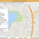
QGIS 3.36.1 freeware

QGIS supports vector, raster, and database formats and lets you browse and create map data ... computer.
QGIS supports many common spatial data formats (e.g. ESRI ShapeFile, geotiff). QGIS supports plugins to do things like display tracks from your GPS.
QGIS aims to be an easy to use GIS, providing common functions and features. The initial goal was to provide a GIS data viewer. ...

Author Gary Sherman
Released 2024-03-26
Filesize 1000.00 MB
Downloads 806
OS Windows XP, Windows Vista, Windows Vista x64, Windows 7, Windows 7 x64, Windows 8, Windows 8 x64, Windows 10, Windows 10 x64, Windows 11
Installation Instal And Uninstall
Keywords geographic information system, map creator, map viewer, GIS, geographic information, create, QGIS
Users' rating
(36 rating)
QGISCADWindows XP, Windows Vista, Windows Vista x64, Windows 7, Windows 7 x64, Windows 8, Windows 8 x64, Windows 10, Windows 10 x64, Windows 11
QGIS - formats file Freeware Download Notice

QGIS Free Download - we do not host any QGIS torrent files or links of QGIS on rapidshare.com, depositfiles.com, megaupload.com etc. All QGIS download links are direct QGIS download from publisher site or their selected mirrors.

QGIS freeware - The Latest User Reviews
QGIS freeware - The Latest Versions History
3.36.1 Mar 26, 2024 New Release
3.36.2 Apr 25, 2024 New Release
3.36.1 Mar 26, 2024 New Release

Most popular CAD freeware downloads

TinyCAD

3.00.04 freeware download

... bitmap. TinyCAD supports outputing ciruits diagrams as PNG files. If you are not familar with PNG files, they are the open-source equivilent of GIFs. All modern web browsers and operating systems support PNG files. You can create PNG files directly from ...

TNTatlas

2024 B20240606 freeware download

... and geospatial data — from a single geodata file to complex map layouts prepared using TNTmips. TNTatlas ... massive sized geodata and will directly display numerous file formats including shapefiles, GeoTIFF, JP2, PNG, MrSID, DXF, ...

QGIS for Mac

3.36.1 freeware download

... (FOSS). QGIS supports vector, raster, and database formats and lets you browse and create map data ... computer. QGIS supports many common spatial data formats (e.g. ESRI ShapeFile, geotiff). QGIS supports plugins to ...

QGIS for Linux

3.36.1 freeware download

... (FOSS). QGIS supports vector, raster, and database formats and lets you browse and create map data ... computer. QGIS supports many common spatial data formats (e.g. ESRI ShapeFile, geotiff). QGIS supports plugins to ...

Digimizer

6.4.0 freeware download

... characteristics. Pictures may be X-rays, micrographs, etc. Supported file formats are JPG, GIF, TIFF, BMP, PNG, WMF, EMF and DICOM files. Images can be rotated, flipped or straightened. ...

SDMetrics

2.5 freeware download

... SDMetrics with reverse engineering tools that produce XMI files from C++, Java, Delphi, or Smalltalk source code, ... exports measurement data and descriptive statistics in various formats (tab-separated text tables, HTML, OpenOffice.org Calc, and XML ...

Mini CAD Viewer

3.7.0.0 freeware download

... on task folders. It supports DWG, DWF, DXF formats. It allows drawing file to be printed. ...

Gnuplot for Windows

5.2.7 freeware download

... display: system-specific (OSX(aqua), svga, ...) direct output to file: postscript (including eps), pdf, png, gif, jpeg, LaTeX, metafont, emf, svg, ... mouseable web display formats: HTML5, svg Features: 2D and 3D ...

PyPedal for Linux

2.0.3 freeware download

... diversity from pedigrees. Features Reading pedigree files in user-defined formats Checking pedigree integrity (duplicate IDs, parents younger than ... such as frequency of appearance in the pedigree file Reordering and renumbering of pedigree files Computation of ...

Gabedit

2.5.1 freeware download

... calculation results including support for most major molecular file formats. The advanced "Molecule Builder" allows to rapidly sketch ... in 3D. Graphics can be exported to various formats, including animations. Major features: Gabedit can ...