QGIS 3.36.2 freeware

New Version

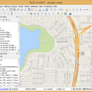
... QGIS aims to be an easy to use GIS, providing common functions and features. The initial goal was to provide a GIS data viewer. ...

Author Gary Sherman
Released 2024-04-25
Filesize 1000.00 MB
Downloads 746
OS Windows XP, Windows Vista, Windows Vista x64, Windows 7, Windows 7 x64, Windows 8, Windows 8 x64, Windows 10, Windows 10 x64, Windows 11
Installation Instal And Uninstall
Keywords geographic information system, map creator, map viewer, GIS, geographic information, create, QGIS
Users' rating
(28 rating)
QGISCADWindows XP, Windows Vista, Windows Vista x64, Windows 7, Windows 7 x64, Windows 8, Windows 8 x64, Windows 10, Windows 10 x64, Windows 11
QGIS - gis mapping software Freeware Download Notice

QGIS Free Download - we do not host any QGIS torrent files or links of QGIS on rapidshare.com, depositfiles.com, megaupload.com etc. All QGIS download links are direct QGIS download from publisher site or their selected mirrors.

QGIS freeware - The Latest User Reviews
QGIS freeware - The Latest Versions History
3.36.2 Apr 25, 2024 New Release
3.36.1 Mar 26, 2024 New Release
3.34.4 Feb 28, 2024 New Release

Most popular CAD freeware downloads

QGIS for Mac

3.36.2 freeware download

QGIS is a professional GIS application that is built on top of and proud to be itself Free and Open Source Software (FOSS). QGIS supports vector, raster, and database ...

New Version

QGIS for Linux

3.36.2 freeware download

QGIS is a professional GIS application that is built on top of and proud to be itself Free and Open Source Software (FOSS). QGIS supports vector, raster, and database ...

New Version

QGIS

3.36.2 freeware download

QGIS is a professional GIS application that is built on top of and proud to be itself Free and Open Source Software (FOSS). QGIS supports vector, raster, and database ...

New Version

ArcReader

10.5.0 B6491 freeware download

ArcReader is a free, easy-to-use desktop mapping application that allows users to view, explore, and ... that was once limited to those with advanced GIS software on their computers. With ArcReader, you ...