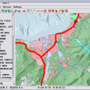
TNTmips 20240404 freeware

... tool that allows you to analyze and modify GIS images. It is a professional application that can handle desktop cartography, electronic atlas preparation and spatial database management. ...

Author MicroImages, Inc.
Released 2024-04-04
Filesize 121.00 MB
Downloads 1674
OS Windows XP, Windows Vista, Windows Vista x64, Windows 7, Windows 7 x64, Windows 8, Windows 8 x64, Windows 10, Windows 10 x64, Windows 11
Installation Instal And Uninstall
Keywords GIS data analysis, analyze geodetic data, edit GIS dataset, GIS, dataset, editor, analysis
Users' rating
(119 rating)
TNTmipsCADWindows XP, Windows Vista, Windows Vista x64, Windows 7, Windows 7 x64, Windows 8, Windows 8 x64, Windows 10, Windows 10 x64, Windows 11
TNTmips - gis Freeware Download Notice

TNTmips Free Download - we do not host any TNTmips torrent files or links of TNTmips on rapidshare.com, depositfiles.com, megaupload.com etc. All TNTmips download links are direct TNTmips download from publisher site or their selected mirrors.

TNTmips freeware - The Latest User Reviews
TNTmips freeware - The Latest Versions History
20240404 Apr 4, 2024 New Release
20240131 Jan 31, 2024 New Release
20240108 Jan 8, 2024 New Release

Most popular CAD freeware downloads

QGIS for Mac

3.36.1 freeware download

QGIS is a professional GIS application that is built on top of and ... QGIS aims to be an easy to use GIS, providing common functions and features. The initial goal ...

JMARS for Windows

3.1.5 freeware download

JMARS is an acronym that stands for Java Mission-planning and Analysis for Remote Sensing. It is a geospatial information system (GIS) developed by ASU's Mars Space ...

ArcReader

10.5.0 B6491 freeware download

... that was once limited to those with advanced GIS software on their computers. With ArcReader, you ... ArcGIS maps using ArcReader (.pmf files). Deploy your GIS data to novices and professionals alike. Zoom, pan, ...

TNTmips for Mac OS X

20240111 freeware download

... Oracle Spatial, DGN, TAB, DXF, DWG. Full-featured GIS that integrates imagery along with geometric data including vector, CAD, shape, pinmap, and TIN formats. Maintain ...

Thuban for Windows

1.2.2 freeware download

... FreeGIS Project provides an overview of Free Software GIS projects. Many valuable and highly sophisticated tools exist, ... information. Thuban makes use of several Free GIS Software components and is itself the basis of ...

Thuban for Mac OS X

1.0.1-3 freeware download

... FreeGIS Project provides an overview of Free Software GIS projects. Many valuable and highly sophisticated tools exist, ... information. Thuban makes use of several Free GIS Software components and is itself the basis of ...

Virtual Terrain Project for Mac OS X and Linux

1.1 110804 freeware download

... a synergetic convergence of the fields of CAD, GIS, visual simulation, surveying and remote sensing. VTP gathers information and tracks progress in areas such as ...

JMARS

3.1.5 freeware download

JMARS is an acronym that stands for Java Mission-planning and Analysis for Remote Sensing. It is a geospatial information system (GIS) developed by ASU's Mars Space ...

5 freeware award

GHydraulics

2.1.8 freeware download

GHydraulics is a Quantum GIS plugin that allows to export water supply networks ... flowrates. The functions are accessible from the Quantum GIS plugin menu and toolbars. ...

wxGIS Portable

0.4.1 freeware download

wxGIS is a useful application that allows you to manage and to organize multiple types of geographic information. The program has an Explorer-like interface that is ...