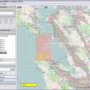
Mobile Atlas Creator 2.2.1 freeware

Mobile Atlas Creator is a small, simple, Java based application specially designed to help you create atlases for TrekBuddy. Basically this software will create offline atlases for GPS handhelds and cell phone applications like TrekBuddy, AndNav and other Android and WindowsCE based applications. ...

Author Fredrik Moller
Released 2021-06-02
Filesize 15.00 MB
Downloads 2285
OS Windows XP, Windows Vista, Windows Vista x64, Windows 7, Windows 7 x64, Windows 8, Windows 8 x64, Windows 10, Windows 10 x64, Linux
Installation Instal And Uninstall
Keywords create atlas, generate atlas, atlas creator, generator, generate, create
Users' rating
(37 rating)
Mobile Atlas CreatorCADWindows XP, Windows Vista, Windows Vista x64, Windows 7, Windows 7 x64, Windows 8, Windows 8 x64, Windows 10, Windows 10 x64, Linux
Mobile Atlas Creator - image file Freeware Download Notice

Mobile Atlas Creator Free Download - we do not host any Mobile Atlas Creator torrent files or links of Mobile Atlas Creator on rapidshare.com, depositfiles.com, megaupload.com etc. All Mobile Atlas Creator download links are direct Mobile Atlas Creator download from publisher site or their selected mirrors.

Mobile Atlas Creator freeware - The Latest User Reviews
Mobile Atlas Creator freeware - The Latest Versions History
2.2.1 Jun 2, 2021 New Release
2.1.3 Rev 24 Apr 14, 2020 New Release Minimum supported Java version increased to Java 8 (1.8)
"mapFile must not be null" error when creating an atlas
Save settings to settings.xml in UTF-8 format (fix for #324)
Map creation error with JPEG (Garmin Custom and others) (fix for #326)
2.1.2 Rev 24 Oct 11, 2019 New Release Minimum supported Java version increased to Java 8 (1.8)
"mapFile must not be null" error when creating an atlas
Save settings to settings.xml in UTF-8 format (fix for #324)
Map creation error with JPEG (Garmin Custom and others) (fix for #326)

Most popular CAD freeware downloads

Techne CAD/CAM x64

1.0.31.0 RC freeware download

... on the drawing. Export or import major CAD file formats. Features: Multithreaded 3D part and ... Flip or mirror designs Manually trace over bitmap image Grid layout with snap to line option ...

DSI Studio

.59 freeware download

... (DSI) · Generalized Q-sampling Imaging (GQI) Supported image format: · DICOM (multi-slices/mosaic) · Analyze/NIFTI · bruker ... of passing and/or regions of avoidace. · Supported file format for input ROI: text file, Analyze, NIFTI ...

Engauge Digitizer for Linux

12.0 freeware download

... This open source, digitizing software converts an image file showing a graph or map, into numbers. The image file can come from a scanner, digital camera ...

Techne CAD/CAM

1.0.31.0 RC freeware download

... on the drawing. Export or import major CAD file formats. Features: Multithreaded 3D part and ... Flip or mirror designs Manually trace over bitmap image Grid layout with snap to line option ...

Portable MicroDicom

2024.2 freeware download

... application for primary processing and preservation of medical images in DICOM format. It is equipped with most common tools for manipulation of DICOM images and it has an intuitive user interface. ...

TinyCAD

3.00.04 freeware download

... Turn your circuit diagrams in to PNG images Although you might want to put the ... bitmap. TinyCAD supports outputing ciruits diagrams as PNG files. If you are not familar with PNG files, ...

MagicPlot Student for Mac OS X

2.9.3 freeware download

... and consistent. Advantages: * Compact: Single file ~2 MB * Multilevel undo function for all ... scaling * Visual nonlinear curve fitting * Vector images export and copying * Automatic formula recalculation on ...

Mobile Atlas Creator

2.2.1 freeware download

... maps can be exported as one large PNG image with calibration MAP file for OziExplorer. As source for an offline atlas ... Trail Explorer (J2ME) - single tiles and MTECache file NaviComputer (Windows Mobile) nfComPass (WinCE, WinMobile, WinXP) OruxMaps ...

Mobile Atlas Creator for Mac OS X

2.2.1 freeware download

... maps can be exported as one large PNG image with calibration MAP file for OziExplorer. As source for an offline atlas ... Trail Explorer (J2ME) - single tiles and MTECache file NaviComputer (Windows Mobile) nfComPass (WinCE, WinMobile, WinXP) OruxMaps ...

MITO

2.0 freeware download

... makes it possible to fetch radiological information and images stored in a PACS according to the standard ... functionalities such as 2D-3D visualization (VR, SR, MIP), image segmentation and fusion, ROI. Moreover, MITO provides interaction ...