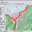
TNTmips 20240404 freeware

TNTmips is a geospatial image processing tool that allows you to analyze and modify GIS images. It is a professional application that can handle desktop cartography, electronic atlas preparation and spatial database management. ...

Author MicroImages, Inc.
Released 2024-04-04
Filesize 121.00 MB
Downloads 1574
OS Windows XP, Windows Vista, Windows Vista x64, Windows 7, Windows 7 x64, Windows 8, Windows 8 x64, Windows 10, Windows 10 x64, Windows 11
Installation Instal And Uninstall
Keywords GIS data analysis, analyze geodetic data, edit GIS dataset, GIS, dataset, editor, analysis
Users' rating
(91 rating)
TNTmipsCADWindows XP, Windows Vista, Windows Vista x64, Windows 7, Windows 7 x64, Windows 8, Windows 8 x64, Windows 10, Windows 10 x64, Windows 11
TNTmips - image file Freeware Download Notice

TNTmips Free Download - we do not host any TNTmips torrent files or links of TNTmips on rapidshare.com, depositfiles.com, megaupload.com etc. All TNTmips download links are direct TNTmips download from publisher site or their selected mirrors.

TNTmips freeware - The Latest User Reviews
TNTmips freeware - The Latest Versions History
20240404 Apr 4, 2024 New Release
20240131 Jan 31, 2024 New Release
20240108 Jan 8, 2024 New Release

Most popular CAD freeware downloads

TNTmips for Mac OS X

20240111 freeware download

... with virtually any type of geospatial data including imagery, terrain surfaces, and map data with associated database ... without importing. Overlay your geodata on Bing Maps imagery and maps or on geodata layers published on ...

TNTmips

20240404 freeware download

... with virtually any type of geospatial data including imagery, terrain surfaces, and map data with associated database ... without importing. Overlay your geodata on Bing Maps imagery and maps or on geodata layers published on ...

Panoply

5.3.4 freeware download

... whose purpose is to help you plot raster images. It lets you view photos created with NetCDF, ... or slice geo-gridded and other types of arrays. Files can be imported in the working environment using ...

Sweet Home 3D

7.3 freeware download

... draw the walls of your home upon the image of an existing plan, change the color or ... along with the 3D view, create a photorealistic image of the 3D view, and export the plan ...

Digimizer

6.4.0 freeware download

Digimizer is an easy-to-use and flexible image analysis software package that allows precise manual measurements ... characteristics. Pictures may be X-rays, micrographs, etc. Supported file formats are JPG, GIF, TIFF, BMP, PNG, WMF, ...

Mobile Atlas Creator for Mac OS X

2.2.1 freeware download

... maps can be exported as one large PNG image with calibration MAP file for OziExplorer. As source for an offline atlas ... Trail Explorer (J2ME) - single tiles and MTECache file NaviComputer (Windows Mobile) nfComPass (WinCE, WinMobile, WinXP) OruxMaps ...

VEGA ZZ

3.2.3.28 freeware download

... and animation with full support for Accelrys archive file (.arc), AutoDock 4 DLG, BioDock output, CSR (Accelrys ... PDBQT multi-model formats. Snapshot, hardware and software image rendering with the capability to create images bigger ...

Mobile Atlas Creator

2.2.1 freeware download

... maps can be exported as one large PNG image with calibration MAP file for OziExplorer. As source for an offline atlas ... Trail Explorer (J2ME) - single tiles and MTECache file NaviComputer (Windows Mobile) nfComPass (WinCE, WinMobile, WinXP) OruxMaps ...

SeiSee

2.22.6 freeware download

... analyze the data about earthquakes stored in SEG-Y files. The program can also view the content of CWP, CGG and CST files in order to examine the data.You can use ...

Br3D

1.3 freeware download

... weight, fast free 3D Viewer Supports various 3D file format. Read : DWG, DXF, IFC, IFCZIP, STL, ... layer, line type options Save As Save As Image Saves current view as image Object snap Annotation ...