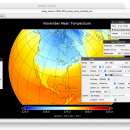
Panoply for Mac 5.4.3 freeware

... an utility that enable user to plot raster image. Depending on the data, it can draw global longitude-latitude images or pole-to-pole latitude-vertical images.Panoply is a cross-platform application which plots geo-gridded arrays from netCDF, HDF and GRIB datasets. The utility can also combine two arrays and can project the analysis using more than 100 maps. ...

Author Robert B. Schmunk
Released 2024-06-24
Filesize 36.40 MB
Downloads 1013
OS Mac OS X
Installation Instal And Uninstall
Keywords plot raster image, longitude image, pole-to-pole image, raster image, rasterize, raster
Users' rating
(43 rating)
Panoply for MacCADMac OS X
Panoply for Mac - image format Freeware Download Notice

Panoply for Mac Free Download - we do not host any Panoply for Mac torrent files or links of Panoply for Mac on rapidshare.com, depositfiles.com, megaupload.com etc. All Panoply for Mac download links are direct Panoply for Mac download from publisher site or their selected mirrors.

Panoply for Mac freeware - The Latest User Reviews
Panoply for Mac freeware - The Latest Versions History
5.4.3 Jun 24, 2024 New Release
5.4.1 Jun 1, 2024 New Release
5.4.0 May 11, 2024 New Release

Most popular CAD freeware downloads

Panoply for Mac

5.4.3 freeware download

... to disk GIF, JPEG, PNG or TIFF bitmap images or as PDF or PostScript graphics files. Export lon-lat map plots in KMZ format. Export animations as MP4 video or as a ...

TinyCAD

3.00.04 freeware download

... Turn your circuit diagrams in to PNG images Although you might want to put the ... Instead of being pasted as a bitmap, the image is pasted as a vector graphic, making it ...

MicroDicom x64

2024.2 freeware download

... application for primary processing and preservation of medical images in DICOM format. It is equipped with most common tools for manipulation of DICOM images and it has an intuitive user interface. ...

Mobile Atlas Creator for Mac OS X

2.2.1 freeware download

... maps can be exported as one large PNG image with calibration MAP file for OziExplorer. As source ... (Android) BackCountry Navigator (Android) Big Planet Tracks SQLite format (Android) CacheBox (Windows Mobile) Cachewolf Garmin Custom Map ...

p3d

2.6.2 freeware download

... tasks in IFS data-reduction. p3d can combine several images (exposures) into one image, clean single images of cosmic-ray hits, can extract spectra using three ... handle the following tasks: Create a master-bias image – any available prescan and overscan regions can ...

DX Central for Linux

2.20 freeware download

... effect on radio propagation. This small application provides images of the sun and vital, timely information about ... sources in a compact and easy to use format. The v2.00 features a new interface with more ...

GpsTools Studio

2.3.1 build 227 freeware download

... you to import a map from a popular image file and to export it to a compatible format. The user can easily scale the ...

Portable MicroDicom

2024.2 freeware download

... application for primary processing and preservation of medical images in DICOM format. It is equipped with most common tools for manipulation of DICOM images and it has an intuitive user interface. ...

CiDess

4.28 freeware download

... - PCB drilling with CNC machine - Special image generation for PCB etching with CNC machine - ... - CiDess is open software, sources and files format description in the coders section of this web ...

TrueSpace

7.61 freeware download

... and render 3D content. As well as traditional images and movies, you can also make 3D content ... Features: Export to Virtual Earth and X format: · An entirely re-written X format exporter lets ...