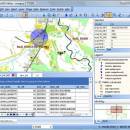
TatukGIS Viewer 5.71.0 freeware

... editing application featuring support for dozens of vector, image, grid, and SQL database formats, on-the-fly map reprojection with nearly 3,000 pre-defined coordinate systems, compatibility with leading database engines, GPS connectivity… ...

Author TatukGIS Sp. z o. o.
Released 2024-04-04
Filesize 120.00 MB
Downloads 525
OS Windows XP, Windows Vista, Windows Vista x64, Windows 7, Windows 7 x64, Windows 8, Windows 8 x64, Windows 10, Windows 10 x64, Windows 11
Installation Instal And Uninstall
Keywords raster image Viewer, GIS editor, GIS map, viewer, graphic, view
Users' rating
(27 rating)
TatukGIS ViewerOtherWindows XP, Windows Vista, Windows Vista x64, Windows 7, Windows 7 x64, Windows 8, Windows 8 x64, Windows 10, Windows 10 x64, Windows 11
TatukGIS Viewer - image map Freeware Download Notice

TatukGIS Viewer Free Download - we do not host any TatukGIS Viewer torrent files or links of TatukGIS Viewer on rapidshare.com, depositfiles.com, megaupload.com etc. All TatukGIS Viewer download links are direct TatukGIS Viewer download from publisher site or their selected mirrors.

TatukGIS Viewer freeware - The Latest User Reviews
TatukGIS Viewer freeware - The Latest Versions History
5.71.0 Apr 4, 2024 New Release
5.70.0 Feb 24, 2024 New Release
5.69.0 Jan 29, 2024 New Release

Most popular Other freeware downloads

TatukGIS Viewer

5.71.0 freeware download

... editing application featuring support for dozens of vector, image, grid, and SQL database formats, on-the-fly map reprojection with nearly 3,000 pre-defined coordinate systems, compatibility ... The Editor and Viewer open most GIS/CAD vector map files, raster maps, aerial images, grid data, and ...

ClickCharts Free Flowchart Software

9.18 freeware download

... diagrams with seamless sheet overlapping. *Export flowcharts as image files such as jpg, gif, png and more. ...

ClickCharts Free Flowchart for Android

9.18 freeware download

... diagrams with seamless sheet overlapping. *Export flowcharts as image files such as jpg, gif, png and more. ...

Mkgmap

4919 freeware download

... means of converting OpenStreetMaps information, specifically tags, into image maps, which can then be loaded onto Garmin ... mkgmap program takes OpenStreetMap data and generates a map in the Garmin .img file format so that ...

ClickCharts FlowCharts Free for Mac

9.15 freeware download

... create strong visuals of an organization, process, mind map, UML diagram and more. Map out your value streams and data flow. Find ... diagrams with seamless sheet overlapping. *Export flowcharts as image files such as jpg, gif, png and more. ...

GeoSetter

3.5.3 freeware download

... for of imshowing and changing geo data of image files (e.g. images taken by digital cameras).The user interface is available ... Harvey for writing data Shows existing geo coordinates, image directions and tracks on embedded Google Maps map ...

Portable AMP Tile Viewer

2.01 freeware download

... utiliy desgned to enable you to view your images images as a mosaic, using the image like a tile texture. FEATURES: · Shows the images as a mosaic, using the loaded image as ...

AMP Tile Viewer

2.01 freeware download

... utiliy desgned to enable you to view your images images as a mosaic, using the image like a tile texture. FEATURES: · Shows the images as a mosaic, using the loaded image as ...

5 freeware award

Noiser

1.0 freeware download

... allows you to easily create textures using various image generating algorithms and 3D noise parameters. This technique of dynamically rendering images, rather than using precomputed static pixel bitmaps, is ...

Terra Incognita

2.45 freeware download

... Terra Incognita™ main features: navigating through map by simple clicking generating OziExplorer, Kmz, JNX, GPSdash or TrekBuddy calibrated map file possibility to use many web map sources ...