M4 PERSONAL 7.0 freeware

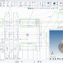
... advanced commercial package, includes basic 3D, parametrics, colour image integration and sheet metal design. The free download is available in English, German, French and Italian. Sheets carry a "not for commercal use" watermark (which can be removed via the eSERVICES pay-per-result portal). ...

Author CAD Schroer GmbH
Released 2021-01-12
Filesize 470.70 MB
Downloads 460
OS Windows 10
Installation Install and Uninstall
Keywords CAD, Software, Freeware
Users' rating
(18 rating)
M4 PERSONALCADWindows 10
M4 PERSONAL - image or clone Freeware Download Notice

M4 PERSONAL Free Download - we do not host any M4 PERSONAL torrent files or links of M4 PERSONAL on rapidshare.com, depositfiles.com, megaupload.com etc. All M4 PERSONAL download links are direct M4 PERSONAL download from publisher site or their selected mirrors.

M4 PERSONAL freeware - The Latest User Reviews
M4 PERSONAL freeware - The Latest Versions History
7.0 Jan 12, 2021 Major Update A new version under a new brand brings even easier access to standard formats and direct integration with online services
6.3 Mar 13, 2019 Major Update Completely New User Interface, New Catalog and Symbol Browser, Tablet Support, User Interface customisation, MEDUSA4 in the Cloud, Sending Drawings as e-mail, Printing with Preview, QR Codes, Shortcuts
6.1 Apr 27, 2016 Major Update Completely New User Interface, New Catalog and Symbol Browser, Tablet Support, User Interface customisation, MEDUSA4 in the Cloud, Sending Drawings as e-mail, Printing with Preview, QR Codes, Shortcuts

Most popular CAD freeware downloads

Panoply for Mac

5.4.3 freeware download

... to disk GIF, JPEG, PNG or TIFF bitmap images or as PDF or PostScript graphics files. Export ... video or as a collection of invididual frame images. Explore remote THREDDS and OpenDAP catalogs and open ...

Gwyddion for Linux

2.66 freeware download

... generally used for any other height field and image analysis, for instance for analysis of profilometry data ... axes scale callibration · merging and immersion of images · tip modelling, blind estimation, dilation and erosion ...

MicroDicom

2024.2 freeware download

... application for primary processing and preservation of medical images in DICOM format. It is equipped with most common tools for manipulation of DICOM images and it has an intuitive user interface. ...

MarvinSketch

23.16.0 freeware download

... Structure and valence checker Working with abbreviated groups Image generation, display and formatting ...

Gwyddion

2.66 freeware download

... generally used for any other height field and image analysis, for instance for analysis of profilometry data ... axes scale callibration · merging and immersion of images · tip modelling, blind estimation, dilation and erosion ...

MicroDicom x64

2024.2 freeware download

... application for primary processing and preservation of medical images in DICOM format. It is equipped with most common tools for manipulation of DICOM images and it has an intuitive user interface. ...

QFitsView

8.6 freeware download

... core, DS9 excels in displaying and analyzing astronomical images, supporting a wide array of file formats including ... noteworthy, ensuring that users can work with high-resolution images without performance bottlenecks. One of DS9's standout ...

Portable MicroDicom

2024.2 freeware download

... application for primary processing and preservation of medical images in DICOM format. It is equipped with most common tools for manipulation of DICOM images and it has an intuitive user interface. ...

Portable MicroDicom x64

2024.2 freeware download

... application for primary processing and preservation of medical images in DICOM format. It is equipped with most common tools for manipulation of DICOM images and it has an intuitive user interface. ...

TNTmips

20240404 freeware download

... with virtually any type of geospatial data including imagery, terrain surfaces, and map data with associated database ... without importing. Overlay your geodata on Bing Maps imagery and maps or on geodata layers published on ...