Geogiga Front End 9.0 freeware

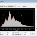
Geogiga Front End is designed to QC and preprocess single shot record. You can convert data formats, analyze amplitude decay, correct trigger delay, assign geometry, mute seismic traces, run frequency filter, gain control, vertical stacking, and such. ...

Author Geogiga Technology Corp.
Released 2019-10-02
Filesize 6.02 MB
Downloads 645
OS Windows XP, Windows Vista, Windows Vista x64, Windows 7, Windows 7 x64
Installation Instal And Uninstall
Keywords preprocess seismic data, analyze amplitude decay, correct trigger delay, viewer, editor, correct
Users' rating
(23 rating)
Geogiga Front EndCADWindows XP, Windows Vista, Windows Vista x64, Windows 7, Windows 7 x64
Geogiga Front End - include Freeware Download Notice

Geogiga Front End Free Download - we do not host any Geogiga Front End torrent files or links of Geogiga Front End on rapidshare.com, depositfiles.com, megaupload.com etc. All Geogiga Front End download links are direct Geogiga Front End download from publisher site or their selected mirrors.

Geogiga Front End freeware - The Latest User Reviews
Geogiga Front End freeware - The Latest Versions History
9.0 Oct 2, 2019 New Release
8.0 Aug 20, 2015 New Release
7.1 Oct 25, 2012 New Release · Fixed the bugs in reading SEG-D and SEG-Y.

Most popular CAD freeware downloads

Online CAD Converter

1.5 freeware download

... CAD, CGM, HPGL, SVG files. Output file types include PDF, TIFF, JPEG, EMF, CGM, HPGL, and SVG. You do not have to install any software ...

CiDess

4.28 freeware download

... sort easily your PCB files - You can include comments and extra data in a PCB file - Automatic web page generation to publish your ...

TNTatlas

2024 B20240606 freeware download

... be a growing secondary responsibility. Your duties may include making spatial information available to a wide audience in an easily used form. You may be ...

TNTatlas for Mac OS X

2024 B20240508 freeware download

... be a growing secondary responsibility. Your duties may include making spatial information available to a wide audience in an easily used form. You may be ...

TNTmips

20240404 freeware download

... types and a multitude of Coordinate Reference Systems. Include layers in a wide variety of external formats without importing. Overlay your geodata on Bing Maps ...

TrueSpace

7.61 freeware download

... Windows or the Xbox 360. · Also included is an export to Virtual Earth which will ... 3D objects and scenes. · The improvements include the ability to sweep edges as well as ...

JMARS

3.1.5 freeware download

... TES and Viking. For the Moon, datasets include Clementine UV/VIS multispectral imaging, Lunar Orbiter imaging, Arecibo ... Reconnaissance Orbiter. For Earth (in beta-development), datasets include topography and ASTER and MODIS multispectral imaging. ...

5 freeware award

DirectMath x64

3.2.3 freeware download

... publishing mathematical content. Key features of the editor include Tool buttons that make it easy to ... controling the computer algebra system. DirectMath x64 includes a set of drawing tools that allow you ...

GstarCAD MC

3.3.1 freeware download

... Visual mode and 3D Visual mode, 3D mode include: 3D Wireframe, Realistic and 3D Hidden with the powerful tools of Layer, Layout, and ten different ...

GOM Inspect

7.5 SR1 freeware download

... Professional data sets. Features from GOM Inspect include CAD Data and 3D Point Cloud Import 3D Mesh Processing 3D Inspection Tools 2D Analysis ...