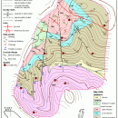
TNTatlas for Mac OS X 2023 B20230323 freeware

TNTatlas is a powerful free geodata viewer that lets you publish and distribute your maps and geospatial data — from a single geodata file to complex map layouts prepared using TNTmips. TNTatlas lets you display massive sized geodata and will directly display numerous file formats including shapefiles, GeoTIFF, JP2, PNG, MrSID, DXF, and DWG. ...

Author MicroImages, Inc.
Released 2023-03-23
Filesize 87.90 MB
Downloads 724
OS Mac OS X
Installation Instal And Uninstall
Keywords geospatial viewer, view atlas, visualize geospatial data, atlas, map, viewer
Users' rating
(42 rating)
TNTatlas for Mac OS XCADMac OS X
TNTatlas for Mac OS X - information management Freeware Download Notice

TNTatlas for Mac OS X Free Download - we do not host any TNTatlas for Mac OS X torrent files or links of TNTatlas for Mac OS X on rapidshare.com, depositfiles.com, megaupload.com etc. All TNTatlas for Mac OS X download links are direct TNTatlas for Mac OS X download from publisher site or their selected mirrors.

TNTatlas for Mac OS X freeware - The Latest User Reviews
TNTatlas for Mac OS X freeware - The Latest Versions History
2023 B202303 Mar 23, 2023 New Release
2022 B202212 Dec 7, 2022 New Release
2022 B202211 Nov 30, 2022 New Release

Most popular CAD freeware downloads

TNTmips for Mac OS X

20240111 freeware download

TNTmips for Mac is a complete Geographic Information System (GIS) that lets you work with virtually ... of natural terrains and mathematical surfaces from 3D information. Fast and efficient Surface Fitting, Contouring, and Triangulation ...

TNTmips

20240404 freeware download

TNTmips software is a complete Geographic Information System (GIS) that lets you work with virtually ... of natural terrains and mathematical surfaces from 3D information. Fast and efficient Surface Fitting, Contouring, and Triangulation ...

WireCAD

6.0.0.1462 freeware download

... (dwg,dxf) documentation, draw and manage cable and connection information, automatically create functional block diagrams from user equipment definitions or download over 23000+ definitions from WireCAD's ...

TNTatlas for Mac OS X

2023 B20230323 freeware download

... JP2, PNG, MrSID, DXF, and DWG. Geospatial information plays a growing part in the way we ... concern in your professional life, or such spatial information may be a growing secondary responsibility. Your duties ...

FreeDiams for Mac OS X

1.0.0 freeware download

... interactions database (source: AFSSAPS) give access to many informations: interactions by themselves risk level nature of the risk management of the interaction FreeDiams' original purpose was ...

Thuban for Windows

1.2.2 freeware download

... features methods to visualize, explore, and analyze geographic information. Thuban is an Interactive Geographic Data Viewer ... need for a user-friendly, interactive viewer for geographic information. Thuban makes use of several Free GIS ...

Thuban for Mac OS X

1.0.1-3 freeware download

... features methods to visualize, explore, and analyze geographic information. Thuban is an Interactive Geographic Data Viewer ... need for a user-friendly, interactive viewer for geographic information. Thuban makes use of several Free GIS ...

Thuban for Linux

1.2.2 freeware download

... features methods to visualize, explore, and analyze geographic information. Thuban is an Interactive Geographic Data Viewer ... need for a user-friendly, interactive viewer for geographic information. Thuban makes use of several Free GIS ...

KMWin

1.52 freeware download

... Features Main Window - Creation and management of survival time plots, modification of curve properties ... limits and labels, marking censored times, adding an information text or a legend, inverting survival time curves, ...

TNTatlas

2022 B20221207 freeware download

... JP2, PNG, MrSID, DXF, and DWG. Geospatial information plays a growing part in the way we ... concern in your professional life, or such spatial information may be a growing secondary responsibility. Your duties ...