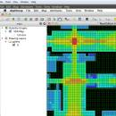
UCL Depthmap 0.8.0 freeware

Depthmap is a single software platform to perform a set of spatial network analyses designed to understand social processes within the built environment. It works at a variety of scales from building through small urban to whole cities or states. ...

Author University College London
Released 2020-11-08
Filesize 35.10 MB
Downloads 1392
OS Windows XP, Windows Vista, Windows Vista x64, Windows 7, Windows 7 x64, Windows 8, Windows 8 x64, Windows 10, Windows 10 x64, Windows 11
Installation Instal And Uninstall
Keywords urban environment, urban map, spatial network analysis, environment, map, analysis
Users' rating
(28 rating)
UCL DepthmapCADWindows XP, Windows Vista, Windows Vista x64, Windows 7, Windows 7 x64, Windows 8, Windows 8 x64, Windows 10, Windows 10 x64, Windows 11
UCL Depthmap - layer 2 Freeware Download Notice

UCL Depthmap Free Download - we do not host any UCL Depthmap torrent files or links of UCL Depthmap on rapidshare.com, depositfiles.com, megaupload.com etc. All UCL Depthmap download links are direct UCL Depthmap download from publisher site or their selected mirrors.

UCL Depthmap freeware - The Latest User Reviews
UCL Depthmap freeware - The Latest Versions History
0.8.0 Nov 8, 2020 New Release General:
Allow for pushing values from shapemaps (axial maps, segment maps) to VGA
Fix VGA map connections export
Make drawing to segment conversion faster
Test and fix shape removal for axial and data maps
Allow pushing the Ref or Key value to another layer
Fix MIF/MID import (allow for empty columns, PR #369)
Fix diagonal line handling on VGA map fill (PR #326, thanks Piotr Piastucki!)
Change C++ standard to 17
Graphical User Interface (GUI):
Highlight shapes and pixels on hover (can be disabled in the settings)
Allow inserting any number in the table (PR #356)
Fix a case where the app would crash with multiple unlinking in VGA (PR #328)
Fix convex map hover and selection (PR #368)
Allow generating multiple isovists by importing a CSV file
Fix a case where VGA progress bar would end, but analysis would still be going (PR #323)
0.7.0 Jun 7, 2019 New Release
0.30 Sep 18, 2014 New Release

Most popular CAD freeware downloads

QGIS for Mac

3.36.1 freeware download

... analysis · On the fly projection of vector layers · Map composer · Identify features · Display ... applications · Improved MapServer export tool · Vector layer transparency and antialiasing · GRASS support in all ...

ArcReader

10.5.0 B6491 freeware download

... be contained in these maps through the multiple layers supported by PMF documents can be viewed up ... Print published map and globe documents including all layer symbology and cartographic map elements on any supported ...

DipTrace Free

4.3.0.0 freeware download

... boards automatically with a full control over the layer stackup. Smart manual routing tools allow designing complex high-density boards with differential pairs and high-speed data ...

Thuban for Windows

1.2.2 freeware download

... features: # Vector Data Support: Shapefile, PostGIS Layer and OGR # Raster Data Support: GeoTIFF Layer and GDAL # Comfortable Map Navigation # Object ... Statusbar * Toolbar and * Menubar Layer Properties Aside the layer title the properties dialog ...

Thuban for Mac OS X

1.0.1-3 freeware download

... features: # Vector Data Support: Shapefile, PostGIS Layer and OGR # Raster Data Support: GeoTIFF Layer and GDAL # Comfortable Map Navigation # Object ... Statusbar * Toolbar and * Menubar Layer Properties Aside the layer title the properties dialog ...

Sonnet Lite

18.53 freeware download

Sonnet Lite™ is a free feature-limited version of Sonnet's professional Sonnet Suites, which provides EM analysis to thousands of companies across the globe. Many major manufacturers ...

BabaCAD

2.0.0 freeware download

... high precision Organize and group objects with layers and blocks Draw and modify 2D vector ... line types, line widths by block or by layer Insert images of standard image formats (jpg, ...

GstarCAD MC

3.3.1 freeware download

... Scale, Color, Measure object, record management results, manage layers and use Layout. • Advanced drawing and editing ... and 3D Hidden with the powerful tools of Layer, Layout, and ten different perspectives viewing. • Rotate ...

Elshayal Smart

23.02 freeware download

... jpg, bmp and Edit shape files, build new layer, add existing layer, remove layers, swap layers, save layer, set layer data source, layer properties, zoom in ...

QGIS

3.36.1 freeware download

... analysis · On the fly projection of vector layers · Map composer · Identify features · Display ... applications · Improved MapServer export tool · Vector layer transparency and antialiasing · GRASS support in all ...