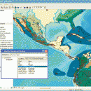
ArcReader 10.5.0 B6491 freeware

ArcReader is a free, easy-to-use desktop mapping application that allows users to view, explore, and print maps and globes. ArcReader is a free and easy-to-use application that allows users to view and print maps that are published as Published Map Files (PMF) by the ArcGIS Publisher extension to ArcView, ArcEditor, and ArcInfo. ...

Author ESRI
Released 2017-02-02
Filesize 444.00 MB
Downloads 588
OS Windows XP, Windows Vista, Windows Vista x64, Windows 7, Windows 7 x64, Windows 8, Windows 8 x64
Installation Instal And Uninstall
Keywords view map, print PMF map, export bitmap, view, viewer, map, print
Users' rating
(27 rating)
ArcReaderCADWindows XP, Windows Vista, Windows Vista x64, Windows 7, Windows 7 x64, Windows 8, Windows 8 x64
ArcReader - layer Freeware Download Notice

ArcReader Free Download - we do not host any ArcReader torrent files or links of ArcReader on rapidshare.com, depositfiles.com, megaupload.com etc. All ArcReader download links are direct ArcReader download from publisher site or their selected mirrors.

ArcReader freeware - The Latest User Reviews
ArcReader freeware - The Latest Versions History
10.5.0 B6491 Feb 2, 2017 New Release
10.4 B5524 Apr 10, 2016 New Release
10.3 B4332 Jan 2, 2015 New Release

Most popular CAD freeware downloads

Elshayal Smart

23.02 freeware download

... jpg, bmp and Edit shape files, build new layer, add existing layer, remove layers, swap layers, save layer, set layer data source, layer properties, zoom in ...

QGIS for Mac

3.36.1 freeware download

... analysis · On the fly projection of vector layers · Map composer · Identify features · Display ... applications · Improved MapServer export tool · Vector layer transparency and antialiasing · GRASS support in all ...

DipTrace Free

4.3.0.0 freeware download

... boards automatically with a full control over the layer stackup. Smart manual routing tools allow designing complex high-density boards with differential pairs and high-speed data ...

QGIS for Linux

3.36.1 freeware download

... analysis · On the fly projection of vector layers · Map composer · Identify features · Display ... applications · Improved MapServer export tool · Vector layer transparency and antialiasing · GRASS support in all ...

GstarCAD MC

3.3.1 freeware download

... Scale, Color, Measure object, record management results, manage layers and use Layout. • Advanced drawing and editing ... and 3D Hidden with the powerful tools of Layer, Layout, and ten different perspectives viewing. • Rotate ...

UCL Depthmap

0.8.0 freeware download

... and the measures may be transferred to gate layers in order to compare with indicators of pedestrian ... · OpenStreetMap, Tiger Line and Ordnance Survey ITN layer loaders · Text, SVG and EPS export ...

BabaCAD

2.0.0 freeware download

... high precision Organize and group objects with layers and blocks Draw and modify 2D vector ... line types, line widths by block or by layer Insert images of standard image formats (jpg, ...

QGIS

3.36.1 freeware download

... analysis · On the fly projection of vector layers · Map composer · Identify features · Display ... applications · Improved MapServer export tool · Vector layer transparency and antialiasing · GRASS support in all ...

Digimizer

6.4.0 freeware download

... Binarization Options: overlay binary image, hide binary layer Morphological operations: Dilate, Erode, Open, Close Noise reduction Analyze objects: object detection with measurement of perimeter ...

Sonnet Lite

18.53 freeware download

Sonnet Lite™ is a free feature-limited version of Sonnet's professional Sonnet Suites, which provides EM analysis to thousands of companies across the globe. Many major manufacturers ...