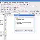
VisualCAM 1.0.5.0 freeware

VisualCAM is a handy application that allows you to create geometry models and to host other CAM applications. You can create a model from scratch or to load the files designed in other applications in order to preview and edit them. The program offers support for plugins that are used to enhance the program's functions and capabilities. ...

Author MecSoft Corporation
Released 2012-05-10
Filesize 29.30 MB
Downloads 480
OS Windows XP, Windows Vista, Windows Vista x64, Windows 7, Windows 7 x64
Installation Instal And Uninstall
Keywords create part file, 3D model design, DXF viewer, create, model, design
Users' rating
(11 rating)
VisualCAMCADWindows XP, Windows Vista, Windows Vista x64, Windows 7, Windows 7 x64
VisualCAM - layer Freeware Download Notice

VisualCAM Free Download - we do not host any VisualCAM torrent files or links of VisualCAM on rapidshare.com, depositfiles.com, megaupload.com etc. All VisualCAM download links are direct VisualCAM download from publisher site or their selected mirrors.

VisualCAM freeware - The Latest User Reviews
VisualCAM freeware - The Latest Versions History
1.0.5.0 May 10, 2012 New Release

Most popular CAD freeware downloads

CARIS Easy View

4.2.13 freeware download

... of files. It allows you to load multiple layers, change their order and adjust object parameters. View ... in which they are drawn and adjust each layer's display parameters. Users can also make selections and ...

QGIS for Mac

3.36.1 freeware download

... analysis · On the fly projection of vector layers · Map composer · Identify features · Display ... applications · Improved MapServer export tool · Vector layer transparency and antialiasing · GRASS support in all ...

QGIS for Linux

3.36.1 freeware download

... analysis · On the fly projection of vector layers · Map composer · Identify features · Display ... applications · Improved MapServer export tool · Vector layer transparency and antialiasing · GRASS support in all ...

DipTrace Free

4.3.0.0 freeware download

... boards automatically with a full control over the layer stackup. Smart manual routing tools allow designing complex high-density boards with differential pairs and high-speed data ...

UCL Depthmap

0.8.0 freeware download

... and the measures may be transferred to gate layers in order to compare with indicators of pedestrian ... · OpenStreetMap, Tiger Line and Ordnance Survey ITN layer loaders · Text, SVG and EPS export ...

Thuban for Windows

1.2.2 freeware download

... features: # Vector Data Support: Shapefile, PostGIS Layer and OGR # Raster Data Support: GeoTIFF Layer and GDAL # Comfortable Map Navigation # Object ... Statusbar * Toolbar and * Menubar Layer Properties Aside the layer title the properties dialog ...

Thuban for Mac OS X

1.0.1-3 freeware download

... features: # Vector Data Support: Shapefile, PostGIS Layer and OGR # Raster Data Support: GeoTIFF Layer and GDAL # Comfortable Map Navigation # Object ... Statusbar * Toolbar and * Menubar Layer Properties Aside the layer title the properties dialog ...

Thuban for Linux

1.2.2 freeware download

... features: # Vector Data Support: Shapefile, PostGIS Layer and OGR # Raster Data Support: GeoTIFF Layer and GDAL # Comfortable Map Navigation # Object ... Statusbar * Toolbar and * Menubar Layer Properties Aside the layer title the properties dialog ...

VisualCAM

1.0.5.0 freeware download

... in any of the viewports · Select by Layer, Color, Type & Name · Select by geometry types (Points, Lines/Polylines, Arcs/Circles, Polycurves, Dimensions, Surfaces) ...

Sonnet Lite

18.53 freeware download

Sonnet Lite™ is a free feature-limited version of Sonnet's professional Sonnet Suites, which provides EM analysis to thousands of companies across the globe. Many major manufacturers ...