UCL Depthmap 0.8.0 freeware

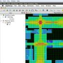
Depthmap is a single software platform to perform a set of spatial network analyses designed to understand social processes within the built environment. It works at a variety of scales from building through small urban to whole cities or states. ...

Author University College London
Released 2020-11-08
Filesize 35.10 MB
Downloads 1379
OS Windows XP, Windows Vista, Windows Vista x64, Windows 7, Windows 7 x64, Windows 8, Windows 8 x64, Windows 10, Windows 10 x64, Windows 11
Installation Instal And Uninstall
Keywords urban environment, urban map, spatial network analysis, environment, map, analysis
Users' rating
(28 rating)
UCL DepthmapCADWindows XP, Windows Vista, Windows Vista x64, Windows 7, Windows 7 x64, Windows 8, Windows 8 x64, Windows 10, Windows 10 x64, Windows 11
UCL Depthmap - line in Freeware Download Notice

UCL Depthmap Free Download - we do not host any UCL Depthmap torrent files or links of UCL Depthmap on rapidshare.com, depositfiles.com, megaupload.com etc. All UCL Depthmap download links are direct UCL Depthmap download from publisher site or their selected mirrors.

UCL Depthmap freeware - The Latest User Reviews
UCL Depthmap freeware - The Latest Versions History
0.8.0 Nov 8, 2020 New Release General:
Allow for pushing values from shapemaps (axial maps, segment maps) to VGA
Fix VGA map connections export
Make drawing to segment conversion faster
Test and fix shape removal for axial and data maps
Allow pushing the Ref or Key value to another layer
Fix MIF/MID import (allow for empty columns, PR #369)
Fix diagonal line handling on VGA map fill (PR #326, thanks Piotr Piastucki!)
Change C++ standard to 17
Graphical User Interface (GUI):
Highlight shapes and pixels on hover (can be disabled in the settings)
Allow inserting any number in the table (PR #356)
Fix a case where the app would crash with multiple unlinking in VGA (PR #328)
Fix convex map hover and selection (PR #368)
Allow generating multiple isovists by importing a CSV file
Fix a case where VGA progress bar would end, but analysis would still be going (PR #323)
0.7.0 Jun 7, 2019 New Release
0.30 Sep 18, 2014 New Release

Most popular CAD freeware downloads

Panoply for Mac

5.4.3 freeware download

... arrays from 2D or larger multidimensional variables. Create line plots of data from 1D or larger multidimensional ... 200 map projections or make a zonal average line plot. Overlay continent outlines or masks on lon-lat ...

SDMetrics

2.5 freeware download

... outliers, browse histograms and Kiviat charts. Command line interface: · The measurement and data export features are also accessible via a command line interface. Automated analysis runs allow you to integrate ...

FreeDiams for Mac OS X

1.0.0 freeware download

... linked to any application thanks to its command line parameters. FreeDiams can manage multiple drugs databases. Some drugs databases are already available: French ...

Kst for Linux

2.0.7 freeware download

Kst is the fastest real-time large-dataset viewing and plotting tool available (you may be interested in some benchmarks) and has built-in data analysis functionality. Kst is ...

GstarCAD MC

3.3.1 freeware download

... 3D Spherical coordinates and Cylindrical coordinates. • Draw Line, Polyline, Circle, Arc, Text, Revcloud, Rectangle, and Sketch and create Notation. (7) Stay connected. Helpful and ...

Digimizer

6.4.0 freeware download

... unit of measurement measure distances and lengths of line segments or paths measure perimeters and areas measure angles locate middle of line segment find center and calculate characteristics of circular ...

Aqsis Renderer for Windows

1.8.2 freeware download

Open source 3D rendering solution adhering to the RenderMan standard Aqsis is a cross-platform photorealistic 3D rendering solution, adhering to the RenderMan interface standard ...

Aqsis Renderer for Mac OS X

1.8.2 freeware download

Open source 3D rendering solution adhering to the RenderMan standard Aqsis for Mac OS X is a cross-platform photorealistic 3D rendering solution, adhering to ...

Gwyddion

2.66 freeware download

... logarithmical, gradient- and edge-detected, local contrast representation, Canny lines · OpenGL 3D data display: false color or ... facet leveling, polynomial background removal, leveling along user-defined lines · value reading, distance and angle measurement · ...

UCL Depthmap

0.8.0 freeware download

... segment maps, or segment maps, such as road-centre line maps, may be imported directly. These may be ... MapInfo MIF / MID import · OpenStreetMap, Tiger Line and Ordnance Survey ITN layer loaders · Text, ...