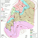
TNTatlas for Mac OS X 2023 B20230323 freeware

... and geospatial data — from a single geodata file to complex map layouts prepared using TNTmips. TNTatlas ... massive sized geodata and will directly display numerous file formats including shapefiles, GeoTIFF, JP2, PNG, MrSID, DXF, and DWG. ...

Author MicroImages, Inc.
Released 2023-03-23
Filesize 87.90 MB
Downloads 724
OS Mac OS X
Installation Instal And Uninstall
Keywords geospatial viewer, view atlas, visualize geospatial data, atlas, map, viewer
Users' rating
(42 rating)
TNTatlas for Mac OS XCADMac OS X
TNTatlas for Mac OS X - make help file Freeware Download Notice

TNTatlas for Mac OS X Free Download - we do not host any TNTatlas for Mac OS X torrent files or links of TNTatlas for Mac OS X on rapidshare.com, depositfiles.com, megaupload.com etc. All TNTatlas for Mac OS X download links are direct TNTatlas for Mac OS X download from publisher site or their selected mirrors.

TNTatlas for Mac OS X freeware - The Latest User Reviews
TNTatlas for Mac OS X freeware - The Latest Versions History
2023 B202303 Mar 23, 2023 New Release
2022 B202212 Dec 7, 2022 New Release
2022 B202211 Nov 30, 2022 New Release

Most popular CAD freeware downloads

SearchGUI

4.3.9 freeware download

... DirecTag. To start using SearchGUI, unzip the downloaded file, and double-click the SearchGUI-X.Y.Z.jar file. No additional installation required! The main purpose of SearchGUI is to make it simpler to use multiple search engines at ...

New Version

Panoply

5.3.4 freeware download

... a cross-platform software application whose purpose is to help you plot raster images. It lets you view ... or slice geo-gridded and other types of arrays. Files can be imported in the working environment using ...

SearchGUI for Mac and Linux

4.3.9 freeware download

... DirecTag. To start using SearchGUI, unzip the downloaded file, and double-click the SearchGUI-X.Y.Z.jar file. No additional installation required! The main purpose of SearchGUI is to make it simpler to use multiple search engines at ...

New Version

PreviSat

6.1.0.3 freeware download

... real-time or manual mode. PreviSat is able to make predictions of their passes and also Iridium flares. ... a satellite tracking software whose purpose is to help you monitor and observe the position of artificial ...

Gephi

0.10.1 freeware download

... to reveal hidden properties. The goal is to help data analysts to make hypothesis, intuitively discover patterns, isolate structure singularities or ... component. · Import temporal graph with the GEXF file format · Graph streaming ready Create cartography: ...

Gephi for Linux

0.10.1 freeware download

... to reveal hidden properties. The goal is to help data analysts to make hypothesis, intuitively discover patterns, isolate structure singularities or ... component. · Import temporal graph with the GEXF file format · Graph streaming ready Create cartography: ...

Gephi for Mac OS X

0.10.1 freeware download

... to reveal hidden properties. The goal is to help data analysts to make hypothesis, intuitively discover patterns, isolate structure singularities or ... component. · Import temporal graph with the GEXF file format · Graph streaming ready Create cartography: ...

TNTatlas for Mac OS X

2023 B20230323 freeware download

... and geospatial data — from a single geodata file to complex map layouts prepared using TNTmips. TNTatlas ... massive sized geodata and will directly display numerous file formats including shapefiles, GeoTIFF, JP2, PNG, MrSID, DXF, ...

TinyCAD

3.00.04 freeware download

TinyCAD is a program to help you draw circuit diagrams. It comes complete with ... in Word TinyCAD has some features to make it easier for you to put your circuit ...

TNTatlas

2022 B20221207 freeware download

... and geospatial data — from a single geodata file to complex map layouts prepared using TNTmips. TNTatlas ... massive sized geodata and will directly display numerous file formats including shapefiles, GeoTIFF, JP2, PNG, MrSID, DXF, ...