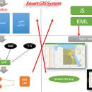
Elshayal Smart 23.02 freeware

Download Maps from Google Earth, and Trace & save GPS route and View and Rectify Raster Images gif, jpg, bmp and Edit shape files, build new layer, add existing layer, remove layers, swap layers, save layer, set layer data source, layer properties, zoom in & zoom out, pan, identify, selecting features, invert selection, show data table, data query builder, location query builder, build network. ...

Author Elshayal Smart Web On Line Software
Released 2023-02-28
Filesize 6.00 MB
Downloads 517
OS Windows Vista, Windows Vista x64, Windows 7, Windows 7 x64, Windows 8, Windows 8 x64, Windows 10, Windows 10 x64
Installation Instal And Uninstall
Keywords edit map, GIS editor, edit GIS, GIS, editor, raster
Users' rating
(13 rating)
Elshayal SmartCADWindows Vista, Windows Vista x64, Windows 7, Windows 7 x64, Windows 8, Windows 8 x64, Windows 10, Windows 10 x64
Elshayal Smart - map software Freeware Download Notice

Elshayal Smart Free Download - we do not host any Elshayal Smart torrent files or links of Elshayal Smart on rapidshare.com, depositfiles.com, megaupload.com etc. All Elshayal Smart download links are direct Elshayal Smart download from publisher site or their selected mirrors.

Elshayal Smart freeware - The Latest User Reviews
Elshayal Smart freeware - The Latest Versions History
23.02 Feb 28, 2023 New Release
21.02 Jan 26, 2021 New Release
21.01 Jan 12, 2021 New Release

Most popular CAD freeware downloads

TNTmips for Mac OS X

20240111 freeware download

... of geospatial data including imagery, terrain surfaces, and map data with associated database attributes. It provides all ... published on the Internet as web tilesets, Web Map Service (WMS), and ArcIMS. Automatically generate hundreds ...

QGIS for Mac

3.36.1 freeware download

... proud to be itself Free and Open Source Software (FOSS). QGIS supports vector, raster, and database formats and lets you browse and create map data on your computer. QGIS supports many ...

QGIS for Linux

3.36.1 freeware download

... proud to be itself Free and Open Source Software (FOSS). QGIS supports vector, raster, and database formats and lets you browse and create map data on your computer. QGIS supports many ...

TNTmips

20240404 freeware download

TNTmips software is a complete Geographic Information System (GIS) that ... of geospatial data including imagery, terrain surfaces, and map data with associated database attributes. It provides all ...

QGIS

3.36.1 freeware download

... proud to be itself Free and Open Source Software (FOSS). QGIS supports vector, raster, and database formats and lets you browse and create map data on your computer. QGIS supports many ...

Panoply

5.3.4 freeware download

... HDF and GRIB datasets. Panoply is a cross-platform software application whose purpose is to help you plot ... format. Panoply is a noteworthy and comprehensive software application that helps you plot and analyze raster ...

UCL Depthmap

0.8.0 freeware download

Depthmap is a single software platform to perform a set of spatial network ... states. At each scale, the aim of the software is to produce a map of open space ...

Elshayal Smart

23.02 freeware download

Elshayal Smart is the first Arabian GIS software that is completely developed by Arabian developers team and independent of any commercial software package. Download Maps from Google Earth, and ...

GeoMapApp

3.7.1 freeware download

GeoMapApp is a map-based application for browsing, visualizing and analyzing a diverse ... Imported table values can be edited and the map symbol, color and size are adjustable. Tabular values ...

Mobile Atlas Creator for Mac OS X

2.2.1 freeware download

... exported as one large PNG image with calibration MAP file for OziExplorer. As source for an offline ... OpenStreetMap, Google Maps, Yahoo Maps and other online map providers. Features: Create offline atlases for ...