Navigation:
Engauge Digitizer for Mac OS X 12.0 freeware
Engauge Digitizer - Digitizing software
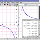
This open source, digitizing software converts an image file showing a graph or map, into numbers. The image file can come from ... with an image file containing a graph or map. The final result is digitized data that can be used by other tools such as Microsoft Excel. ...
| Author | Mark Mitchell |
| Released | 2019-08-19 |
| Filesize | 10.10 MB |
| Downloads | 940 |
| OS | Mac OS X |
| Installation | Instal And Uninstall |
| Keywords | digitize image, image to number, process image, digitize, convert, digitizer |
| Users' rating (38 rating) |
|
| Our rating |

|
Engauge Digitizer for Mac OS X Free Download - we do not host any Engauge Digitizer for Mac OS X torrent files or links of Engauge Digitizer for Mac OS X on rapidshare.com, depositfiles.com, megaupload.com etc. All Engauge Digitizer for Mac OS X download links are direct Engauge Digitizer for Mac OS X download from publisher site or their selected mirrors.
| 12.0 | Aug 19, 2019 | New Release | New hourglass and triangle point types (#346) Fix data export for log scale data when step factor is less than one (#345) |
| 10.4 | Oct 11, 2017 | New Release | Show warning message when grid line maximum is exceed (#244) CSV export files have double quotes on fields with internal commas (#243) Status bar shows all of text for right-to-left languages (#240) |
| 5.1 | Dec 24, 2012 | New Release | Fix for broken point matching, and control of the x/theta axis label. |


