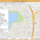
QGIS 3.36.1 freeware

... database formats and lets you browse and create map data on your computer.
QGIS supports many common spatial data formats (e.g. ESRI ShapeFile, geotiff). QGIS supports plugins to do things like display tracks from your GPS.
QGIS aims to be an easy to use GIS, providing common functions and features. The initial goal was to provide a GIS data viewer. ...

Author Gary Sherman
Released 2024-03-26
Filesize 1000.00 MB
Downloads 806
OS Windows XP, Windows Vista, Windows Vista x64, Windows 7, Windows 7 x64, Windows 8, Windows 8 x64, Windows 10, Windows 10 x64, Windows 11
Installation Instal And Uninstall
Keywords geographic information system, map creator, map viewer, GIS, geographic information, create, QGIS
Users' rating
(36 rating)
QGISCADWindows XP, Windows Vista, Windows Vista x64, Windows 7, Windows 7 x64, Windows 8, Windows 8 x64, Windows 10, Windows 10 x64, Windows 11
QGIS - map software Freeware Download Notice

QGIS Free Download - we do not host any QGIS torrent files or links of QGIS on rapidshare.com, depositfiles.com, megaupload.com etc. All QGIS download links are direct QGIS download from publisher site or their selected mirrors.

QGIS freeware - The Latest User Reviews
QGIS freeware - The Latest Versions History
3.36.1 Mar 26, 2024 New Release
3.36.2 Apr 25, 2024 New Release
3.36.1 Mar 26, 2024 New Release

Most popular CAD freeware downloads

QGIS for Linux

3.36.1 freeware download

... proud to be itself Free and Open Source Software (FOSS). QGIS supports vector, raster, and database formats and lets you browse and create map data on your computer. QGIS supports many ...

Engauge Digitizer for Mac OS X

12.0 freeware download

Engauge Digitizer - Digitizing software This open source, digitizing software converts an image file showing a graph or map, into numbers. The image file can come from ...

5 freeware award

Engauge Digitizer for Linux

12.0 freeware download

Engauge Digitizer - Digitizing software This open source, digitizing software converts an image file showing a graph or map, into numbers. The image file can come from ...

CARIS Easy View

4.2.13 freeware download

... of file types without the need for specialized software. CARIS Easy View gives users control of the data. Users can load multiple raster, point ...

Elshayal Smart

23.02 freeware download

Elshayal Smart is the first Arabian GIS software that is completely developed by Arabian developers team and independent of any commercial software package. Download Maps from Google Earth, and ...

QGIS

3.36.1 freeware download

... proud to be itself Free and Open Source Software (FOSS). QGIS supports vector, raster, and database formats and lets you browse and create map data on your computer. QGIS supports many ...

QGIS for Mac

3.36.1 freeware download

... proud to be itself Free and Open Source Software (FOSS). QGIS supports vector, raster, and database formats and lets you browse and create map data on your computer. QGIS supports many ...

GeoMapApp

3.7.1 freeware download

GeoMapApp is a map-based application for browsing, visualizing and analyzing a diverse ... Imported table values can be edited and the map symbol, color and size are adjustable. Tabular values ...

TNTmips for Mac OS X

20240111 freeware download

... of geospatial data including imagery, terrain surfaces, and map data with associated database attributes. It provides all ... published on the Internet as web tilesets, Web Map Service (WMS), and ArcIMS. Automatically generate hundreds ...

Mobile Atlas Creator

2.2.1 freeware download

... exported as one large PNG image with calibration MAP file for OziExplorer. As source for an offline ... OpenStreetMap, Google Maps, Yahoo Maps and other online map providers. Features: Create offline atlases for ...