QGIS for Linux 3.36.2 freeware

New Version

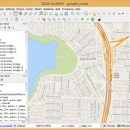
QGIS supports vector, raster, and database formats and lets you browse and create map data on your computer.
QGIS supports many common spatial data formats (e.g. ESRI ShapeFile, geotiff). QGIS supports plugins to do things like display tracks from your GPS.
QGIS aims to be an easy to use GIS, providing common functions and features. The initial goal was to provide a GIS data viewer. ...

Author Gary Sherman
Released 2024-04-25
Filesize 1.00 MB
Downloads 750
OS Linux
Installation Instal And Uninstall
Keywords geographic information system, map creator, map viewer, GIS, geographic information, create, QGIS for Linux
Users' rating
(34 rating)
QGIS for LinuxCADLinux
QGIS for Linux - point Freeware Download Notice

QGIS for Linux Free Download - we do not host any QGIS for Linux torrent files or links of QGIS for Linux on rapidshare.com, depositfiles.com, megaupload.com etc. All QGIS for Linux download links are direct QGIS for Linux download from publisher site or their selected mirrors.

QGIS for Linux freeware - The Latest User Reviews
QGIS for Linux freeware - The Latest Versions History
3.36.2 Apr 25, 2024 New Release
3.36.1 Mar 26, 2024 New Release
3.34.4 Feb 28, 2024 New Release

Most popular CAD freeware downloads

QGIS for Linux

3.36.2 freeware download

... a GIS data viewer. QGIS has reached that point in its evolution and is being used by many for their daily GIS data viewing needs. ...

New Version

QGIS for Mac

3.36.2 freeware download

... a GIS data viewer. QGIS has reached that point in its evolution and is being used by many for their daily GIS data viewing needs. ...

New Version

QGIS

3.36.2 freeware download

... a GIS data viewer. QGIS has reached that point in its evolution and is being used by many for their daily GIS data viewing needs. ...

New Version

Sweet Home 3D

7.3 freeware download

... navigate in it either from an aerial view point, or from a virtual visitor view point. Finally, you can improve your home plan by ... simultaneously view it in 3D from an aerial point of view, or navigate into it from a ...

Gwyddion

2.65 freeware download

Gwyddion is a modular program for SPM (scanning probe microscopy) data visualization and analysis. Primarily it is intended for analysis of height fields obtained by scanning ...

Gwyddion for Linux

2.65 freeware download

Gwyddion is a modular program for SPM (scanning probe microscopy) data visualization and analysis. Primarily it is intended for analysis of height fields obtained by scanning ...

UCL Depthmap

0.8.0 freeware download

... in a number of ways. It can produce point isovists, that is, polygons representing the visually accessible ... of isovists into a visibility graph of intervisible points (with graphs of up to about 1000000 point ...

BabaCAD

2.0.0 freeware download

... Draw and modify 2D vector objects like point, line, rectangle, polyline with arc segments, circle, arc, hatch with patterns, text, block, dimension, image ...

GetNexrad

4.4.2 freeware download

... radar rainfall loops and to generate the basin point file (NexradPointESX10210.txt) used by GetRealtime.exe for computing the ... and graphical storm tracking. Storm ETA at any point of interest. Alarms! for Weather Service issued warnings. ...

GOM Inspect

7.5 SR1 freeware download

... mesh processing software for dimensional analysis of 3D point clouds and viewer for ATOS and GOM Inspect ... GOM Inspect include CAD Data and 3D Point Cloud Import 3D Mesh Processing 3D Inspection Tools ...