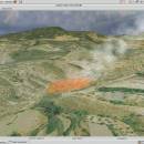
Virtual Terrain Project for Windows 1.1 110804 freeware

The goal of VTP is to foster the creation of tools for easily constructing any part of the real world in interactive, 3D digital form.

This goal will require a synergetic convergence of the fields of CAD, GIS, visual simulation, surveying and remote sensing. VTP gathers information and tracks progress in areas such as procedural scene construction, feature extraction, and rendering algorithms. ...

Author Ben Discoe
Released 2011-09-08
Filesize 1.00 MB
Downloads 501
OS Windows 2000, Windows 2003, Windows XP, Windows Vista
Installation Instal And Uninstall
Keywords libraries, demos, data, open source, VirtualTerrain Project, CAD, GIS, VTP
Users' rating
(21 rating)
Virtual Terrain Project for WindowsCADWindows 2000, Windows 2003, Windows XP, Windows Vista
Virtual Terrain Project for Windows - project software Freeware Download Notice

Virtual Terrain Project for Windows Free Download - we do not host any Virtual Terrain Project for Windows torrent files or links of Virtual Terrain Project for Windows on rapidshare.com, depositfiles.com, megaupload.com etc. All Virtual Terrain Project for Windows download links are direct Virtual Terrain Project for Windows download from publisher site or their selected mirrors.

Virtual Terrain Project for Windows freeware - The Latest User Reviews
Virtual Terrain Project for Windows freeware - The Latest Versions History
1.1 110804 Sep 8, 2011 New Release Enviro:
Exposed support for more stereo modes: Horizontal and Vertical split.
Options to enable joystick and spacenavigator, rather than just always using them if present.
Smooth continuous update when making buildings.
Option to constrain building point to right angles. Deter user from making bad points.
Made support for Collada (.dae) more explicit in the UI.
Display the version number in the startup dialog.
Added 'every N meters' option to Contour dialog, making it significantly more useful.
Changed 'Move' mode to use Alt modifier key for up/down, to be consistent.
Fixed issues with: support for elevation grids with non-unit vertical scale; removing layers from a terrain; saving snapshot and high-resolution snapshot; buildings with a Geographic CRS; draping of 2D polylines on terrain with vertical exaggeration.

VTBuilder:
Raw layers: Draw polygon holes as dotted lines to tell them from outer edges.

Most popular CAD freeware downloads

CADEMIA for Mac

3.0 RC3 freeware download

Existing software tools for the planning process have severe limitations: ... purposes it is now available as open source software for the practitioner. A long time experience in ...

RADlab

1.03 freeware download

Virtual Radiation Detection Experiment Open Source Software Radiation detection and measurement education is necessary ... basically implemented using stopping power data from SRIM software [4] and NIST database [5]. Gamma detectors in ...

SolidFace 3D CAD PTV

24.0.0.X freeware download

Professional 3D Modeling Software (CAD) PTV - A CAD rebuilt with everything ... Assembly and Drawing module; Communication with other CAD software via standard X_T, X_B, DWG, DXF, STL, BMP, ...

MITO

2.0 freeware download

The "MITO - Medical Imaging TOolkit" project coagulates a number of activities aimed at defining and implementing an open-source, cross-platform software architecture for advanced Medical Imaging. MITO toolkit makes ...

Ctrax for Linux

0.5.19b freeware download

... freely moving flies. Our primary goal in this project is to provide quantitative behavior analysis tools to ... broad palette of individual and social behaviors. This software inputs the trajectories output by Ctrax and computes ...

CARIS Easy View

4.2.13 freeware download

... of file types without the need for specialized software. CARIS Easy View gives users control of the data. Users can load multiple raster, point ...

Elshayal Smart

23.02 freeware download

Elshayal Smart is the first Arabian GIS software that is completely developed by Arabian developers team and independent of any commercial software package. Download Maps from Google Earth, and ...

3D Home Design by Livecad

3.1 freeware download

... design, display, present and realise all your building projects! In this brand new 3.1 version, discover an ... an interior work wizard, materials manager, a smart project browser, and a catalogue with an even more ...

Virtual Terrain Project for Mac OS X and Linux

1.1 110804 freeware download

... algorithms. VTP writes and supports a set of software tools, including an interactive runtime environment (VTP Enviro). The tools and their source code are freely ...

SCIRun

4.7 freeware download

... source. Acknowledgement: SCIRun is an Open Source software project that is principally funded through the SCI Institute's ... funding applications that make use of NIH/NCRR CIBC software or data sets. ...