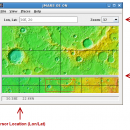
JMARS 3.1.5 freeware

... Analysis for Remote Sensing. It is a geospatial information system (GIS) developed by ASU's Mars Space Flight Facility to provide mission planning and data-analysis tools to NASA's orbiters, instrument team members, students of all ages, and the general public. ...

Author Arizona State University
Released 2014-08-12
Filesize 50.00 MB
Downloads 755
OS Linux, Mac OS X
Installation Instal And Uninstall
Keywords mission analysis, geospatial information, GIS analysis, mission, analysis, GIS
Users' rating
(22 rating)
JMARSCADLinux, Mac OS X
Our rating 5 freeware award
JMARS - s m a r t information Freeware Download Notice

JMARS Free Download - we do not host any JMARS torrent files or links of JMARS on rapidshare.com, depositfiles.com, megaupload.com etc. All JMARS download links are direct JMARS download from publisher site or their selected mirrors.

JMARS freeware - The Latest User Reviews
JMARS freeware - The Latest Versions History
3.1.5 Aug 12, 2014 New Release - In JMARS, locate the "Options" tab at the top of the screen, click it
- Click "Check for Updates"
3.0.4 Jun 7, 2013 New Release - minor change that will allow users to use Body->reset layers to reset layers to JMARS default/startup state
- minor bug fix in the interaction of the Main view and Panner views
- accuracy of crater layer settings improved when saving crater layers as part of a saved session
- more graceful error handling when loading a saved session
- removed the ESRI option from the list for loading/saving in the shape layer. The Geo tools ESRI option is the replacement
- a fix for a drawing issue in the TES layer on Mac OS X running Java 7
- lower right corner coordinates added to the high resolution export tool including new UI functionality for setting export height and width
- update to how image corners (lat/lon) are specified in high resolution export
- added CSV export and look and feel changes to the Investigate tool
- improved communication between the Stamp Layer and backend databases
- Add Layer UI look and feel improvements
- ease of use changes to crater counting layer for small bodies
1.25 Aug 22, 2011 New Release General:
· The Look and Feel of JMARS should now be more consistent with the platform it is on.

Map Layer:
· Added a "View Citations" button to the source section of the Map Layer focus panel.
· Custom Map Upload fix to prevent

Most popular CAD freeware downloads

Kst for Linux

2.0.7 freeware download

... is expandable with plugins and extensions (see developer information in the "Ressources" section). FEATURES: · Robust plotting of live "streaming" data. · Powerful ...

DSI Studio

.59 freeware download

... values according to track coordinates and export related information to text files or MAT files(for Matlab) · ... images in tractography by linear transform with mutual information as cost function. Visualization: · Real time ...

GProX

1.1.16 freeware download

... Plot regulations in an instant · Request database information of-the-fly Enrichment Analysis: · Test for over-represented protein features · Select from several statistical approaches ...

QGIS for Mac

3.36.1 freeware download

QGIS is a professional GIS application that is built on top of and proud to be itself Free and Open Source Software (FOSS). QGIS supports ...

eMachineShop 3D CAD

1.52 freeware download

... change. Like the price? Enter yrour credit card information and in a few weeks, your finished parts arrive - in spec and on time - ...

Antenna Design Calculator

2.3 freeware download

... required for a given antenna. Most of this information is normally available using unwieldy equations; but the antenna calculator gives answers in seconds. ...

FreeDiams for Mac OS X

1.0.0 freeware download

... interactions database (source: AFSSAPS) give access to many informations: interactions by themselves risk level nature of ... time With option to configure dynamic blocking alerts Information about the interactions available: The interacting INN or ...

DWSIM

6.6.2 freeware download

... Refluxed and Reboiled Absorbers. DWSIM also provides special information about the simulation and different means of inputting user data through Utilities and Tools: Utilities: Phase ...

Thuban for Windows

1.2.2 freeware download

... features methods to visualize, explore, and analyze geographic information. Thuban is an Interactive Geographic Data Viewer ... need for a user-friendly, interactive viewer for geographic information. Thuban makes use of several Free GIS ...

SketchEl

1.60 freeware download

... MOL file format, though not not necessarily without information loss. Molecule diagrams are rendered interactively in high quality, and can also be exported as SVG ...