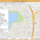
QGIS 3.36.1 freeware

QGIS supports vector, raster, and database formats and lets you browse and create map data on your computer.
QGIS supports many common spatial data formats (e.g. ESRI ShapeFile, geotiff). QGIS supports plugins to do things like display tracks from your GPS.
QGIS aims to be an easy to use GIS, providing common functions and features. The initial goal was to provide a GIS data viewer. ...

Author Gary Sherman
Released 2024-03-26
Filesize 1000.00 MB
Downloads 876
OS Windows XP, Windows Vista, Windows Vista x64, Windows 7, Windows 7 x64, Windows 8, Windows 8 x64, Windows 10, Windows 10 x64, Windows 11
Installation Instal And Uninstall
Keywords geographic information system, map creator, map viewer, GIS, geographic information, create, QGIS
Users' rating
(38 rating)
QGISCADWindows XP, Windows Vista, Windows Vista x64, Windows 7, Windows 7 x64, Windows 8, Windows 8 x64, Windows 10, Windows 10 x64, Windows 11
QGIS - s m a r t information Freeware Download Notice

QGIS Free Download - we do not host any QGIS torrent files or links of QGIS on rapidshare.com, depositfiles.com, megaupload.com etc. All QGIS download links are direct QGIS download from publisher site or their selected mirrors.

QGIS freeware - The Latest User Reviews
QGIS freeware - The Latest Versions History
3.36.1 Mar 26, 2024 New Release
3.36.2 Apr 25, 2024 New Release
3.36.1 Mar 26, 2024 New Release

Most popular CAD freeware downloads

GProX

1.1.16 freeware download

... Plot regulations in an instant · Request database information of-the-fly Enrichment Analysis: · Test for over-represented protein features · Select from several statistical approaches ...

TNTatlas

2024 B20240606 freeware download

... JP2, PNG, MrSID, DXF, and DWG. Geospatial information plays a growing part in the way we ... concern in your professional life, or such spatial information may be a growing secondary responsibility. Your duties ...

QGIS for Linux

3.36.1 freeware download

QGIS is a professional GIS application that is built on top of and proud to be itself Free and Open Source Software (FOSS). QGIS supports ...

TNTatlas for Mac OS X

2024 B20240508 freeware download

... JP2, PNG, MrSID, DXF, and DWG. Geospatial information plays a growing part in the way we ... concern in your professional life, or such spatial information may be a growing secondary responsibility. Your duties ...

TNTmips

20240404 freeware download

TNTmips software is a complete Geographic Information System (GIS) that lets you work with virtually ... of natural terrains and mathematical surfaces from 3D information. Fast and efficient Surface Fitting, Contouring, and Triangulation ...

eMachineShop 3D CAD

1.52 freeware download

... change. Like the price? Enter yrour credit card information and in a few weeks, your finished parts arrive - in spec and on time - ...

QGIS for Mac

3.36.1 freeware download

QGIS is a professional GIS application that is built on top of and proud to be itself Free and Open Source Software (FOSS). QGIS supports ...

Axdea 3D CAD, BIM based IBS Score

1.1.6 freeware download

... use of Material and IFC file for Building Information Modeling. 3) Spreadsheet: Extract data from the models to spreadsheet and export to CSV format 4) ...

Prode Valves

1.08 freeware download

... and requiring to enter only the strictly necessary information, this saves time and reduces the possibility of errors. Integration with Prode Properties Prode ...

DWSIM

6.6.2 freeware download

... Refluxed and Reboiled Absorbers. DWSIM also provides special information about the simulation and different means of inputting user data through Utilities and Tools: Utilities: Phase ...