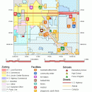
TNTatlas 2024 B20240606 freeware

TNTatlas is a powerful free geodata viewer that lets you publish and distribute your maps and geospatial data — from a single geodata file to complex map layouts prepared using TNTmips. TNTatlas lets you display massive sized geodata and will directly display numerous file formats including shapefiles, GeoTIFF, JP2, PNG, MrSID, DXF, and DWG. ...

Author MicroImages, Inc.
Released 2024-06-06
Filesize 59.00 MB
Downloads 2454
OS Windows XP, Windows Vista, Windows Vista x64, Windows 7, Windows 7 x64, Windows 8, Windows 8 x64, Windows 10, Windows 10 x64, Windows 11
Installation Instal And Uninstall
Keywords geospatial viewer, view atlas, visualize geospatial data, atlas, map, viewer
Users' rating
(69 rating)
TNTatlasCADWindows XP, Windows Vista, Windows Vista x64, Windows 7, Windows 7 x64, Windows 8, Windows 8 x64, Windows 10, Windows 10 x64, Windows 11
TNTatlas - s m a r t information Freeware Download Notice

TNTatlas Free Download - we do not host any TNTatlas torrent files or links of TNTatlas on rapidshare.com, depositfiles.com, megaupload.com etc. All TNTatlas download links are direct TNTatlas download from publisher site or their selected mirrors.

TNTatlas freeware - The Latest User Reviews
TNTatlas freeware - The Latest Versions History
2024 B202406 Jun 6, 2024 New Release
2022 B202212 Dec 7, 2022 New Release
2022 B202211 Nov 30, 2022 New Release

Most popular CAD freeware downloads

MarvinSketch

23.16.0 freeware download

... atoms, via “S-group” logic so that any user-defined information can be stored directly with the structural information. FEATURES: Chemical structure drawing Molecular modeling

Prode Valves

1.08 freeware download

... and requiring to enter only the strictly necessary information, this saves time and reduces the possibility of errors. Integration with Prode Properties Prode ...

enCIFer for Mac OS X

1.4 freeware download

The Crystallographic Information File (CIF) is the internationally agreed standard file format for information exchange in crystallography. The CIF standard is supported, ... archives. enCIFer should also be used to add information safely to CIFs without corrupting the strict syntax. ...

wxGIS Portable

0.4.1 freeware download

... manage and to organize multiple types of geographic information. The program has an Explorer-like interface that is able to store the geographic coordinate systems in ...

TNTatlas

2024 B20240606 freeware download

... JP2, PNG, MrSID, DXF, and DWG. Geospatial information plays a growing part in the way we ... concern in your professional life, or such spatial information may be a growing secondary responsibility. Your duties ...

FreeDiams for Mac OS X

1.0.0 freeware download

... interactions database (source: AFSSAPS) give access to many informations: interactions by themselves risk level nature of ... time With option to configure dynamic blocking alerts Information about the interactions available: The interacting INN or ...

Kst for Linux

2.0.7 freeware download

... is expandable with plugins and extensions (see developer information in the "Ressources" section). FEATURES: · Robust plotting of live "streaming" data. · Powerful ...

Thuban for Windows

1.2.2 freeware download

... features methods to visualize, explore, and analyze geographic information. Thuban is an Interactive Geographic Data Viewer ... need for a user-friendly, interactive viewer for geographic information. Thuban makes use of several Free GIS ...

AdvancedHMI

3.99x Patch 3 freeware download

... free software used to build HMIs that display information residing in a PLC. You will find it to be one of the fastest platforms to ...

IPaNema

1.1.0 freeware download

IPaNema reads any NMEA data from one of the serial ports (Com1-15) and delivers the NMEA data to any user selectable port and IP address using ...