Mobile Atlas Creator for Mac OS X 2.2.1 freeware

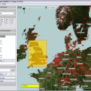
Mobile Atlas Creator is a small, simple, Java based application specially designed to help you create atlases for TrekBuddy. Basically this software will create offline atlases for GPS handhelds and cell phone applications like TrekBuddy, AndNav and other Android and WindowsCE based applications. ...

Author Fredrik Moller
Released 2021-06-02
Filesize 15.00 MB
Downloads 1862
OS Mac OS X
Installation Instal And Uninstall
Keywords create atlas, generate atlas, atlas creator, generator, generate, create
Users' rating
(30 rating)
Mobile Atlas Creator for Mac OS XCADMac OS X
Mobile Atlas Creator for Mac OS X - save image Freeware Download Notice

Mobile Atlas Creator for Mac OS X Free Download - we do not host any Mobile Atlas Creator for Mac OS X torrent files or links of Mobile Atlas Creator for Mac OS X on rapidshare.com, depositfiles.com, megaupload.com etc. All Mobile Atlas Creator for Mac OS X download links are direct Mobile Atlas Creator for Mac OS X download from publisher site or their selected mirrors.

Mobile Atlas Creator for Mac OS X freeware - The Latest User Reviews
Mobile Atlas Creator for Mac OS X freeware - The Latest Versions History
2.2.1 Jun 2, 2021 New Release
2.1.1 Rev 23 Apr 20, 2015 New Release Changed the MOBAC web site URL (e.g. used for online update):
Map source initialization by atlas creation engine added (fix for #313)
Multi-threading issue with TileImageWriter fixed
2.0.0 Alpha Apr 20, 2015 New Release Mapsforge vector maps library updated to 0.5.1
Mapsforge custom caching implemented (required for correct label rendering)

Most popular CAD freeware downloads

Panoply for Mac

5.4.3 freeware download

... own custom ACT, CPT, or RGB color table. Save plots to disk GIF, JPEG, PNG or TIFF bitmap images or as PDF or PostScript graphics files. Export ...

Digimizer

6.4.0 freeware download

Digimizer is an easy-to-use and flexible image analysis software package that allows precise manual measurements ... BMP, PNG, WMF, EMF and DICOM files. Images can be rotated, flipped or straightened. Image brightness ...

SeiSee

2.22.6 freeware download

... variable area, variable density, color) - scaling seismic image, gain control, axes labeling setup - plots seismic to printer (plotter) - exports the image in Windows Bitmap (.bmp) and PostScript formats. - ...

Elshayal Smart

23.02 freeware download

... Download Maps from Google Earth, and Trace & save GPS route and View and Rectify Raster Images gif, jpg, bmp and Edit shape files, build ... layer, add existing layer, remove layers, swap layers, save layer, set layer data source, layer properties, zoom ...

CiDess

4.28 freeware download

... components creation - PCB and layout can be saved as GIF and BMP pictures - PCB can be save as 3DG and STL file - PCB drilling ...

TrueSpace

7.61 freeware download

... and render 3D content. As well as traditional images and movies, you can also make 3D content ... An entirely re-written X format exporter lets you save your trueSpace creations to load into game engines ...

MicroDicom

2024.2 freeware download

... application for primary processing and preservation of medical images in DICOM format. It is equipped with most common tools for manipulation of DICOM images and it has an intuitive user interface. ...

MicroDicom x64

2024.2 freeware download

... application for primary processing and preservation of medical images in DICOM format. It is equipped with most common tools for manipulation of DICOM images and it has an intuitive user interface. ...

Mobile Atlas Creator

2.2.1 freeware download

... maps can be exported as one large PNG image with calibration MAP file for OziExplorer. As source ... OSMtracker (Windows Mobile/Pocket PC) OziExplorer (single 24bit PNG image with calibration (MAP) file PathAway (Windows Mobile) RMaps ...

Mobile Atlas Creator for Mac OS X

2.2.1 freeware download

... maps can be exported as one large PNG image with calibration MAP file for OziExplorer. As source ... OSMtracker (Windows Mobile/Pocket PC) OziExplorer (single 24bit PNG image with calibration (MAP) file PathAway (Windows Mobile) RMaps ...