TNTmips for Mac OS X 20240111 freeware

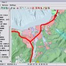
TNTmips is a geospatial image processing tool that allows you to analyze and modify GIS images. It is a professional application that can handle desktop cartography, electronic atlas preparation and spatial database management. ...

Author MicroImages, Inc.
Released 2024-01-11
Filesize 87.90 MB
Downloads 482
OS Mac OS X
Installation Instal And Uninstall
Keywords GIS data analysis, analyze geodetic data, edit GIS dataset, GIS, dataset, editor, analysis, mac os, TNTmips for mac, TNTgis for mac, TNTedit
Users' rating
(21 rating)
TNTmips for Mac OS XCADMac OS X
TNTmips for Mac OS X - single Freeware Download Notice

TNTmips for Mac OS X Free Download - we do not host any TNTmips for Mac OS X torrent files or links of TNTmips for Mac OS X on rapidshare.com, depositfiles.com, megaupload.com etc. All TNTmips for Mac OS X download links are direct TNTmips for Mac OS X download from publisher site or their selected mirrors.

TNTmips for Mac OS X freeware - The Latest User Reviews
TNTmips for Mac OS X freeware - The Latest Versions History
20240111 Jan 11, 2024 New Release
20230323 Mar 23, 2023 New Release
2022 B202212 Dec 7, 2022 New Release

Most popular CAD freeware downloads

TNTmips for Mac OS X

20240111 freeware download

... data. TNTmips provides professional geospatial tools in a single package at an affordable price without costly add-ons. Precisely overlay geodata layers in a variety ...

QGIS for Mac

3.36.2 freeware download

QGIS is a professional GIS application that is built on top of and proud to be itself Free and Open Source Software (FOSS). QGIS supports ...

New Version

QGIS for Linux

3.36.2 freeware download

QGIS is a professional GIS application that is built on top of and proud to be itself Free and Open Source Software (FOSS). QGIS supports ...

New Version

TNTmips

20240404 freeware download

... data. TNTmips provides professional geospatial tools in a single package at an affordable price without costly add-ons. Precisely overlay geodata layers in a variety ...

QGIS

3.36.2 freeware download

QGIS is a professional GIS application that is built on top of and proud to be itself Free and Open Source Software (FOSS). QGIS supports ...

New Version

MarvinSketch

23.16.0 freeware download

... charge, valence, radicals and isotopes to each atom. Single, double, triple bonds and aromatic forms are supported. Moreover, using wedge bonds user can assign stereochemistry ...

UCL Depthmap

0.8.0 freeware download

Depthmap is a single software platform to perform a set of spatial network analyses designed to understand social processes within the built environment. It works ...

Mobile Atlas Creator for Mac OS X

2.2.1 freeware download

... Mobile) Maverick (Android) Mobile Trail Explorer (J2ME) - single tiles and MTECache file NaviComputer (Windows Mobile) nfComPass (WinCE, WinMobile, WinXP) OruxMaps (Android) OsmAnd Osmdroid (Android) ...

GOM Inspect

7.5 SR1 freeware download

... Professional and ATOS Professional is bundled in one single file. GOM Inspect is available for customers and colleagues to review the measurement results and to ...

3D Home Design by Livecad

3.1 freeware download

... Automatic interior quotations - Outline rooms in a single operation - Thousands of 3D objects and textures ... land area - Automatic roof creation with a single click - Parameters can be set for hundreds ...