TNTmips for Mac OS X 20240111 freeware

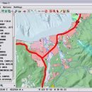
TNTmips is a geospatial image processing tool that allows you to analyze and modify GIS images. It is a professional application that can handle desktop cartography, electronic atlas preparation and spatial database management.

Author MicroImages, Inc.
Released 2024-01-11
Filesize 87.90 MB
Downloads 549
OS Mac OS X
Installation Instal And Uninstall
Keywords GIS data analysis, analyze geodetic data, edit GIS dataset, GIS, dataset, editor, analysis, mac os, TNTmips for mac, TNTgis for mac, TNTedit
Users' rating
(40 rating)
TNTmips for Mac OS XCADMac OS X
TNTmips for Mac OS X - Freeware Download Notice

TNTmips for Mac OS X Free Download - we do not host any TNTmips for Mac OS X torrent files or links of TNTmips for Mac OS X on rapidshare.com, depositfiles.com, megaupload.com etc. All TNTmips for Mac OS X download links are direct TNTmips for Mac OS X download from publisher site or their selected mirrors.

TNTmips for Mac OS X freeware - The Latest User Reviews
TNTmips for Mac OS X freeware - The Latest Versions History
20240111 Jan 11, 2024 New Release
20230323 Mar 23, 2023 New Release
2022 B202212 Dec 7, 2022 New Release

Most popular CAD freeware downloads

Model Air Design

2.5 freeware download

Model Aircraft Design software for Windows PC.

PolyRootsRB for Linux

1.3 freeware download

Finds the roots of a polynomial to any chosen accuracy using Laguerre's Method

miRPI

1.0 freeware download

A software for identify highly conserved miRNAs

3D Home Design by Livecad

3.1 freeware download

Design, display, present, and realize all your building projects

QtGrace

0.2.6 freeware download

Display or plot data, analyze data and prepare it for printing

GelAnalyzer

23.1.1 freeware download

1D gel electrophoresis image analysis made easy

DSI Studio

.59 freeware download

This is a utility for diffusion MR images analysis

GProX

1.1.16 freeware download

Help you analyze and visualize proteomics datasets

QGIS for Mac

3.36.1 freeware download

Lets you browse and create map data on your computer

Panoply for Mac

5.4.3 freeware download

Quickly plot images for the latitude-longitude data contained by netCDF datasets