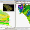
LanDTM 6.1 freeware

There is not any professional program on internet like this and you can get it without any effort. I think this could be a handicap because it's dificult to believe, but it's true; try it and you'll be surprised. It's not only a program to calculate a delaunay triangulation but you can input break-lines to get a real representation of the terrain. ...

Author Aplicaciones Topográficas S.L.
Released 2017-04-23
Filesize 58.80 MB
Downloads 640
OS Windows XP, Windows Vista, Windows Vista x64, Windows 7, Windows 7 x64, Windows 8, Windows 8 x64, Windows 10, Windows 10 x64
Installation Instal And Uninstall
Keywords Delaunay triangulation, Terrain Representation, CAD addon, Delaunay triangulation, Calculate, Terrain
Users' rating
(14 rating)
LanDTMCADWindows XP, Windows Vista, Windows Vista x64, Windows 7, Windows 7 x64, Windows 8, Windows 8 x64, Windows 10, Windows 10 x64
LanDTM - strong Freeware Download Notice

LanDTM Free Download - we do not host any LanDTM torrent files or links of LanDTM on rapidshare.com, depositfiles.com, megaupload.com etc. All LanDTM download links are direct LanDTM download from publisher site or their selected mirrors.

LanDTM freeware - The Latest User Reviews
LanDTM freeware - The Latest Versions History
6.1 Apr 23, 2017 New Release
6.1.6 Feb 16, 2012 New Release · New installers of the program to 32 and 64 bits platforms.
· LanDTM on BricsCAD v12.
· LanDTM on Autocad 2012.
· Separator/discriminator of points.
· Compatibility with "gsf" grid files REDNAP of Geoid ondulation.
· Elevation modification of PPuntos.
· Importation/exportationn of Points to PPuntos.
· Compatibility between formats. Trimble M3, GPS Trimble, GSI of Stonex.
6.1.5 Oct 5, 2011 New Release · You can digitalize lines and points in Google Earth and export them to the CAD. It Works in BricsCAD v11.

Most popular CAD freeware downloads

Rand Tree

2.0 freeware download

RandTree is a MatLab based tree simulator program where the algorithm is based on Honda's model. We have used probabilistic generation of branches in order to ...

Weather Station Data Logger

5.6.0.0 freeware download

This Windows application will display and log weather data obtained through a USB connection to the Oregon Scientific WMR88, WMR100, WMR200 and RMS300 weather stations. You ...

XCircuit

3.8 freeware download

XCircuit: An Introduction There are drawing programs, and there are schematic capture programs. All schematic capture programs will produce output for inclusion in publications. However, ...

EnCalc

4.2 freeware download

EnCalc (Calc4all) is a portable windows calculator with practical built in features! This project started out because there was no other simple portable calculator out there ...

JMARS

3.1.5 freeware download

JMARS is an acronym that stands for Java Mission-planning and Analysis for Remote Sensing. It is a geospatial information system (GIS) developed by ASU's Mars Space ...

5 freeware award

Engauge Digitizer for Linux

12.0 freeware download

Engauge Digitizer - Digitizing software This open source, digitizing software converts an image file showing a graph or map, into numbers. The image file can ...

Model Air Design

2.4 freeware download

Model Air Design is a cross-platform software utility built specifically for helping users create 3D-model aircrafts. While other dedicated CAD tools come packed with many editing ...

TNTmips for Mac OS X

20240111 freeware download

TNTmips for Mac is a complete Geographic Information System (GIS) that lets you work with virtually any type of geospatial data including imagery, terrain surfaces, and ...

TinyCAD

3.00.04 freeware download

TinyCAD is a program to help you draw circuit diagrams. It comes complete with symbol libraries to get you started straight away. As well as being ...

Aqsis Renderer for Windows

1.8.2 freeware download

Open source 3D rendering solution adhering to the RenderMan standard Aqsis is a cross-platform photorealistic 3D rendering solution, adhering to the RenderMan interface standard ...