Engauge Digitizer for Mac OS X 12.0 freeware

Engauge Digitizer - Digitizing software

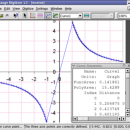
This open source, digitizing software converts an image file showing a graph or map, into numbers. The image file can come from a scanner, digital camera or screenshot. The numbers can be read on the screen, and written or copied to a spreadsheet.

The process starts with an image file containing a graph or map. The final result is digitized ...

Author Mark Mitchell
Released 2019-08-19
Filesize 10.10 MB
Downloads 945
OS Mac OS X
Installation Instal And Uninstall
Keywords digitize image, image to number, process image, digitize, convert, digitizer
Users' rating
(39 rating)
Engauge Digitizer for Mac OS XCADMac OS X
Our rating 5 freeware award
Engauge Digitizer for Mac OS X - support software Freeware Download Notice

Engauge Digitizer for Mac OS X Free Download - we do not host any Engauge Digitizer for Mac OS X torrent files or links of Engauge Digitizer for Mac OS X on rapidshare.com, depositfiles.com, megaupload.com etc. All Engauge Digitizer for Mac OS X download links are direct Engauge Digitizer for Mac OS X download from publisher site or their selected mirrors.

Engauge Digitizer for Mac OS X freeware - The Latest User Reviews
Engauge Digitizer for Mac OS X freeware - The Latest Versions History
12.0 Aug 19, 2019 New Release New hourglass and triangle point types (#346)
Fix data export for log scale data when step factor is less than one (#345)
10.4 Oct 11, 2017 New Release Show warning message when grid line maximum is exceed (#244)
CSV export files have double quotes on fields with internal commas (#243)
Status bar shows all of text for right-to-left languages (#240)
5.1 Dec 24, 2012 New Release Fix for broken point matching, and control of the x/theta axis label.

Most popular CAD freeware downloads

ShareCAD

2.0 freeware download

... Android, iOS, Windows Phone. The following formats are supported: CAD formats: AutoCAD DWG, DXF, DWF, HPGL, PLT; ... formats in any browser without installing any additional software; - zoom and rotate images, change display modes ...

FilterPro Desktop

3.1.0.23446 freeware download

FilterPro v3.1 active filter design software offers a new and improved user interface and ... feedback op amps. FilterPro v3.1 active filter design software is free and available for download now. ...

GeoMapApp

3.7.1 freeware download

... data layering, display customization and analytical tools to support the analysis of multidisciplinary data sets. Choose from ... analysis for data types that typically require specialist software. Examples include seismic reflection profiles and geodetic velocity ...

QGIS for Linux

3.36.1 freeware download

... proud to be itself Free and Open Source Software (FOSS). QGIS supports vector, raster, and database formats and lets you ... create map data on your computer. QGIS supports many common spatial data formats (e.g. ESRI ShapeFile, ...

QFitsView

8.6 freeware download

... robust and versatile astronomical imaging and data visualization software that has become an indispensable tool for astronomers ... DS9 excels in displaying and analyzing astronomical images, supporting a wide array of file formats including FITS, ...

GOM Inspect

7.5 SR1 freeware download

GOM Inspect - Powerful, free software for inspection and mesh processing GOM Inspect is a free 3D inspection and mesh processing software for dimensional analysis of 3D point clouds and ...

VEGA ZZ

3.2.3.28 freeware download

... to make your research jobs very easy. This software is FREE for non-profit academic uses. Extreme ... Simulation trajectory visualization and animation with full support for Accelrys archive file (.arc), AutoDock 4 DLG, ...

CARIS Easy View

4.2.13 freeware download

... of file types without the need for specialized software. CARIS Easy View gives users control of ... important for a geographical data viewer to offer support for multiple types of files, as various GIS ...

QGIS for Mac

3.36.1 freeware download

... proud to be itself Free and Open Source Software (FOSS). QGIS supports vector, raster, and database formats and lets you ... create map data on your computer. QGIS supports many common spatial data formats (e.g. ESRI ShapeFile, ...

PreviSat

6.1.0.3 freeware download

... also Iridium flares. PreviSat is a satellite tracking software whose purpose is to help you monitor and ... about satellites’ passes and Iridium flares. PreviSat offers support for two built-in modes when it comes to ...