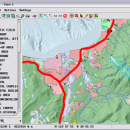
TNTmips 20240404 freeware

TNTmips is a geospatial image processing tool that allows you to analyze and modify GIS images. It is a professional application that can handle desktop cartography, electronic atlas preparation and spatial database management. ...

Author MicroImages, Inc.
Released 2024-04-04
Filesize 121.00 MB
Downloads 1681
OS Windows XP, Windows Vista, Windows Vista x64, Windows 7, Windows 7 x64, Windows 8, Windows 8 x64, Windows 10, Windows 10 x64, Windows 11
Installation Instal And Uninstall
Keywords GIS data analysis, analyze geodetic data, edit GIS dataset, GIS, dataset, editor, analysis
Users' rating
(119 rating)
TNTmipsCADWindows XP, Windows Vista, Windows Vista x64, Windows 7, Windows 7 x64, Windows 8, Windows 8 x64, Windows 10, Windows 10 x64, Windows 11
TNTmips - surface Freeware Download Notice

TNTmips Free Download - we do not host any TNTmips torrent files or links of TNTmips on rapidshare.com, depositfiles.com, megaupload.com etc. All TNTmips download links are direct TNTmips download from publisher site or their selected mirrors.

TNTmips freeware - The Latest User Reviews
TNTmips freeware - The Latest Versions History
20240404 Apr 4, 2024 New Release
20240131 Jan 31, 2024 New Release
20240108 Jan 8, 2024 New Release

Most popular CAD freeware downloads

VEGA ZZ

3.2.3.28 freeware download

... custom. Atom selection & picking. 3D surface: dotted, mesh, solid, solid transparent. Thanks to the HyperDrive technology, the calculation is very fast. The surfaces can be colored by atom, residue, chain, segment, ...

JMARS

3.1.5 freeware download

... registered multilayer image. * Make topographic profiles, extract surface temperatures (day or night), plot footprints and render ... Correlate mineral compositions with topographic data. * Combine surface roughness data with thermal inertia data. * Contour ...

5 freeware award

CARIS Easy View

4.2.13 freeware download

... inspect data from every angle using various visualization, surface draping and filtering techniques. While navigating through the data users can record fly-throughs and export the ...

MeshMagic 3D Modeling Software Free

2.00 freeware download

... meshes. With MeshMagic you can select entire objects, surfaces triangles, lines, or points. Use MeshMagic 3D to transform a 2D outline into A 3D object. ...

TNTmips for Mac OS X

20240111 freeware download

... any type of geospatial data including imagery, terrain surfaces, and map data with associated database attributes. It ... and transform representations of natural terrains and mathematical surfaces from 3D information. Fast and efficient Surface Fitting, ...

Gwyddion for Linux

2.66 freeware download

... kernel · statistical functions: Ra, RMS, projected and surface area, inclination, histograms, 1D and 2D correlation functions, PSDF, 1D and 2D angular distributions, Minkowski functionals, ...

Aqsis Renderer for Windows

1.8.2 freeware download

... motion blur, NURBS, procedural plugins, programmable shading, subdivision surfaces, subpixel displacements and more. The Aqsis tools ... Occlusion * Arbitrary Output Variables (AOV) * Subdivision Surfaces (SDS) * High quality texture mapping * Level ...

Gwyddion

2.66 freeware download

... kernel · statistical functions: Ra, RMS, projected and surface area, inclination, histograms, 1D and 2D correlation functions, PSDF, 1D and 2D angular distributions, Minkowski functionals, ...

CueMol

2.2.3.442 freeware download

... density (CCP4, CNS , and BRIX format), MSMS surface data, and GRASP electrostatic potential map. ...

Pro Yacht

1.0.0.1 freeware download

PolyCAD brings together the best selection of hull surface design techniques together within a user interface which ... The software supports the direct manipulation of NURBS surfaces, parametric hull generation and advanced techniques such as ...