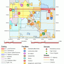
TNTatlas 2022 B20221207 freeware

TNTatlas is a powerful free geodata viewer that lets you publish and distribute your maps and geospatial data — from a single geodata file to complex map layouts prepared using TNTmips. TNTatlas lets you display massive sized geodata and will directly display numerous file formats including shapefiles, GeoTIFF, JP2, PNG, MrSID, DXF, and DWG. ...

Author MicroImages, Inc.
Released 2022-12-07
Filesize 59.00 MB
Downloads 2380
OS Windows XP, Windows Vista, Windows Vista x64, Windows 7, Windows 7 x64, Windows 8, Windows 8 x64, Windows 10, Windows 10 x64, Windows 11
Installation Instal And Uninstall
Keywords geospatial viewer, view atlas, visualize geospatial data, atlas, map, viewer
Users' rating
(58 rating)
TNTatlasCADWindows XP, Windows Vista, Windows Vista x64, Windows 7, Windows 7 x64, Windows 8, Windows 8 x64, Windows 10, Windows 10 x64, Windows 11
TNTatlas - tool Freeware Download Notice

TNTatlas Free Download - we do not host any TNTatlas torrent files or links of TNTatlas on rapidshare.com, depositfiles.com, megaupload.com etc. All TNTatlas download links are direct TNTatlas download from publisher site or their selected mirrors.

TNTatlas freeware - The Latest User Reviews
TNTatlas freeware - The Latest Versions History
2022 B202212 Dec 7, 2022 New Release
2022 B202211 Nov 30, 2022 New Release
2022 B202211 Nov 23, 2022 New Release

Most popular CAD freeware downloads

SearchGUI

4.3.9 freeware download

... option of using SearchGUI as a command line tool. ...

New Version

TNTmips for Mac OS X

20240111 freeware download

... with associated database attributes. It provides all the tools you need to view, create, edit, georeference, interpret, ... type of geospatial data. TNTmips provides professional geospatial tools in a single package at an affordable price ...

FilterPro Desktop

3.1.0.23446 freeware download

... to Excel. FilterPro active filter design tool allows designers to create and edit active filter designs easily using the Filter Design Wizard. Users ...

QGIS for Mac

3.36.1 freeware download

... Improved vector and attribute editing · Improved measure tools with area measuring · Attribute searching · New ... libraries in mapping applications · Improved MapServer export tool · Vector layer transparency and antialiasing · GRASS ...

QGIS for Linux

3.36.1 freeware download

... Improved vector and attribute editing · Improved measure tools with area measuring · Attribute searching · New ... libraries in mapping applications · Improved MapServer export tool · Vector layer transparency and antialiasing · GRASS ...

ProfiCAD

12.4.4 freeware download

... to learn and use, it is a professional tool used by a wide range of customers. FEATURES: easy to learn and use - ...

TNTmips

20240404 freeware download

... with associated database attributes. It provides all the tools you need to view, create, edit, georeference, interpret, ... type of geospatial data. TNTmips provides professional geospatial tools in a single package at an affordable price ...

QGIS

3.36.1 freeware download

... Improved vector and attribute editing · Improved measure tools with area measuring · Attribute searching · New ... libraries in mapping applications · Improved MapServer export tool · Vector layer transparency and antialiasing · GRASS ...

Model Air Design

2.4 freeware download

... users create 3D-model aircrafts. While other dedicated CAD tools come packed with many editing capabilities and parameters ... to create airplane models. It's a modern software tool for aircraft design. Model Air Design is ...

LogicCircuit

2.24.02.27 freeware download

... on the status bar, checkbox on the sliding tool panel on the bottom or use short cut: Ctrl+W. In edit mode on the left side ...