SolidFace 3D CAD PTV 24.0.0.X freeware

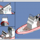
... existing CAD data and using standard X_T, X_B, DWG, DXF, BMP and much more! ...

Author SolidFace Technology Inc
Released 2019-05-01
Filesize 6 kB
Downloads 474
OS Win2000, Windows XP, Windows 7 x32, Windows 7 x64, Windows 8, Windows 10, WinServer, WinOther, Windows Vista, Windows Vista x64
Installation Install and Uninstall
Keywords CAD, Design, freeware, 3D printing, 3D modeling
Users' rating
(25 rating)
SolidFace 3D CAD PTVCADWin2000, Windows XP, Windows 7 x32, Windows 7 x64, Windows 8, Windows 10, WinServer, WinOther, Windows Vista, Windows Vista x64
SolidFace 3D CAD PTV - view dwg Freeware Download Notice

SolidFace 3D CAD PTV Free Download - we do not host any SolidFace 3D CAD PTV torrent files or links of SolidFace 3D CAD PTV on rapidshare.com, depositfiles.com, megaupload.com etc. All SolidFace 3D CAD PTV download links are direct SolidFace 3D CAD PTV download from publisher site or their selected mirrors.

SolidFace 3D CAD PTV freeware - The Latest User Reviews
SolidFace 3D CAD PTV freeware - The Latest Versions History
24.0.0.X May 1, 2019 New Release Import existing CAD data and use SolidFace to collaborate with a vendor. Import existing CAD data and using standard X_T, X_B, DWG, DXF, BMP and much more!
25.0.0-X May 1, 2019 New Release Import existing CAD data and use SolidFace to collaborate with a vendor. Import existing CAD data and using standard X_T, X_B, DWG, DXF, BMP and much more!
24.0.0.X May 1, 2019 New Release Import existing CAD data and use SolidFace to collaborate with a vendor. Import existing CAD data and using standard X_T, X_B, DWG, DXF, BMP and much more!

Most popular CAD freeware downloads

ShareCAD

2.0 freeware download

... developed by CADSoftTools. With its help users can view drawings in web browsers on the following platforms: ... The following formats are supported: CAD formats: AutoCAD DWG, DXF, DWF, HPGL, PLT; Vector formats: PDF, SVG, ...

ZWCAD Viewer

2017 freeware download

Free ZWCAD Viewer for CAD DWG File Viewing and Plotting Light and Easy-to-use No Matter the ... package compared to other demanding software, but ZWCAD Viewer is even much lighter as it does not ...

TNTmips for Mac OS X

20240111 freeware download

... It provides all the tools you need to view, create, edit, georeference, interpret, and publish any type ... shapefile, File Geodatabase, Oracle Spatial, DGN, TAB, DXF, DWG. Full-featured GIS that integrates imagery along with ...

GstarCAD MC

3.3.1 freeware download

GstarCAD MC enables you to view and edit CAD drawings ( DWG, OCF and DXF files) directly on your mobile device after transferring them. DWG FastView is a cross-platform CAD software that meets ...

SolidFace 3D CAD PTV

24.0.0.X freeware download

... existing CAD data and using standard X_T, X_B, DWG, DXF, BMP and much more! Real-Time 3D Cloud ... with other CAD software via standard X_T, X_B, DWG, DXF, STL, BMP, etc. (Standard Version) and Step, ...

VariCAD Viewer 2010 for Linux

3.02 freeware download

A scaled-down version of VariCAD. With the VariCAD Viewer, you can open, view and print your drawings. In addition, this application will also offer you the possibility to view STEP and DWG files. ...

VariCAD Viewer 2011

1.08 freeware download

A scaled-down version of VariCAD. With the VariCAD Viewer, you can open, view and print your drawings. In addition, this application will also offer you the possibility to view STEP and DWG files. ...

VariCAD Viewer 2011 for Linux

1.08 freeware download

A scaled-down version of VariCAD. With the VariCAD Viewer, you can open, view and print your drawings. In addition, this application will also offer you the possibility to view STEP and DWG files. ...

TNTmips

20240404 freeware download

... It provides all the tools you need to view, create, edit, georeference, interpret, and publish any type ... shapefile, File Geodatabase, Oracle Spatial, DGN, TAB, DXF, DWG ... Full-featured GIS that integrates imagery along ...

TNTatlas for Mac OS X

2024 B20240508 freeware download

TNTatlas is a powerful free geodata viewer that lets you publish and distribute your maps ... including shapefiles, GeoTIFF, JP2, PNG, MrSID, DXF, and DWG. Geospatial information plays a growing part in ...