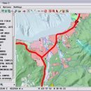
TNTmips for Mac OS X 20240111 freeware

... that allows you to analyze and modify GIS images. It is a professional application that can handle desktop cartography, electronic atlas preparation and spatial database management. ...

Author MicroImages, Inc.
Released 2024-01-11
Filesize 87.90 MB
Downloads 474
OS Mac OS X
Installation Instal And Uninstall
Keywords GIS data analysis, analyze geodetic data, edit GIS dataset, GIS, dataset, editor, analysis, mac os, TNTmips for mac, TNTgis for mac, TNTedit
Users' rating
(21 rating)
TNTmips for Mac OS XCADMac OS X
TNTmips for Mac OS X - view images Freeware Download Notice

TNTmips for Mac OS X Free Download - we do not host any TNTmips for Mac OS X torrent files or links of TNTmips for Mac OS X on rapidshare.com, depositfiles.com, megaupload.com etc. All TNTmips for Mac OS X download links are direct TNTmips for Mac OS X download from publisher site or their selected mirrors.

TNTmips for Mac OS X freeware - The Latest User Reviews
TNTmips for Mac OS X freeware - The Latest Versions History
20240111 Jan 11, 2024 New Release
20230323 Mar 23, 2023 New Release
2022 B202212 Dec 7, 2022 New Release

Most popular CAD freeware downloads

Panoply for Mac

5.3.4 freeware download

... GRIB datasets. Panoply is designed to help you view and process the data included in netCDF, HDF, ... to disk GIF, JPEG, PNG or TIFF bitmap images or as PDF or PostScript graphics files. Export ...

TNTmips for Mac OS X

20240111 freeware download

... It provides all the tools you need to view, create, edit, georeference, interpret, and publish any type of geospatial data. TNTmips provides professional geospatial tools ...

TNTmips

20240404 freeware download

... It provides all the tools you need to view, create, edit, georeference, interpret, and publish any type of geospatial data. TNTmips provides professional geospatial tools ...

Panoply

5.3.4 freeware download

... whose purpose is to help you plot raster images. It lets you view photos created with NetCDF, HDF, GEMPACK, GRIB and ... application that helps you plot and analyze raster images of geo-gridded data from NetCDF and other datasets. ...

Sweet Home 3D

7.3 freeware download

... 2D plan are simultaneously reflected in a 3D view, and you can navigate in it either from an aerial view point, or from a virtual visitor view point. ...

GetNexrad

4.4.2 freeware download

GetNexrad 3.5.2 is a tool used to view real-time area radar rainfall loops and to generate ... up to the past 4 hours of radar images without using GetRealtime you can, and you (and ...

Elshayal Smart

23.02 freeware download

... Earth, and Trace & save GPS route and View and Rectify Raster Images gif, jpg, bmp and Edit shape files, build ...

VEGA ZZ

3.2.3.28 freeware download

... hardware anti-aliasing, material management, 3D backgrounds. Stereo view (shutter or anaglyphic glasses). 10 bit output for each color channel for a smoother view (230 = 1.073.741.824 vs. 224 = 16.777.216 colors). ...

ShareCAD

2.0 freeware download

... developed by CADSoftTools. With its help users can view drawings in web browsers on the following platforms: ... installing any additional software; - zoom and rotate images, change display modes and use measuring tools; - ...

Melanie Viewer

7.0.7 freeware download

... tools to the international scientific community. The Melanie Viewer 7.0 is one of these tools. This Viewer is made available free of charge to help ... by colleagues. It can also be used to view annotated gels from databases such as SWISS-2DPAGE, or ...