CARIS Easy View 4.2.13 freeware

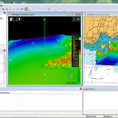
The program can render the loaded spatial data in a three-dimensional mode, allowing you to view your project from any angle. It is even possible to record videos of your fly-throughs and save them to AVI files. ...

Author CARIS
Released 2015-08-27
Filesize 106.00 MB
Downloads 426
OS Windows XP, Windows Vista, Windows Vista x64, Windows 7, Windows 7 x64, Windows 8, Windows 8 x64, Windows 10, Windows 10 x64
Installation Instal And Uninstall
Keywords View Spatial Data, View Map, Analyze Map, Map, Model, Surface, Geography
Users' rating
(10 rating)
CARIS Easy ViewCADWindows XP, Windows Vista, Windows Vista x64, Windows 7, Windows 7 x64, Windows 8, Windows 8 x64, Windows 10, Windows 10 x64
CARIS Easy View - view spatial data Freeware Download Notice

CARIS Easy View Free Download - we do not host any CARIS Easy View torrent files or links of CARIS Easy View on rapidshare.com, depositfiles.com, megaupload.com etc. All CARIS Easy View download links are direct CARIS Easy View download from publisher site or their selected mirrors.

CARIS Easy View freeware - The Latest User Reviews
CARIS Easy View freeware - The Latest Versions History
4.2.13 Aug 27, 2015 New Release Consistent user experience in 2D and 3D
The properties for coverages have been redesigned and apply both in 2D and 3D. A number of new options are presented including the ability to drape high resolution imagery (e.g. backscatter) over elevations in both 2D and 3D views.
Also, a new user interface is provided to investigate the processing lineage of a dataset recorded in the metadata.
Click to return to top of page
Coordinate reference system enhancements
The coordinate reference system (CRS) functionality has been augmented with EPSG CRS and transformations, such as NTv2. The user interface was upgraded with a new look and with additional capabilities. Users can now build a favourites list, see a list of recently used CRS entries, search for new entries and investigate all aspects of the selected reference system or transformation.
Note that if an incorrect CRS has been selected when opening a dataset in the application, it is now possible to change the CRS in the Properties window wh
4.1.11 Aug 27, 2015 New Release Expanded support for commonly used geospatial data formats (e.g. BAG, GeoTIFF, S-57) and web services (WMS, WCS, WMTS, WTMS).
Upgraded support for non-proprietary BAG format to version 1.5.2, which is the latest
version provided by the Open Navigation Surface Working Group.

Most popular CAD freeware downloads

TNTmips for Mac OS X

20240111 freeware download

... you work with virtually any type of geospatial data including imagery, terrain surfaces, and map data with associated database attributes. It provides all the tools you need ...

QGIS for Mac

3.34.4 freeware download

... Software (FOSS). QGIS supports vector, raster, and database formats and lets you browse and create map data on your computer. QGIS supports many common ...

TNTmips

20240131 freeware download

... you work with virtually any type of geospatial data including imagery, terrain surfaces, and map data with associated database attributes. It provides all the tools you need ...

QGIS

3.34.4 freeware download

... Software (FOSS). QGIS supports vector, raster, and database formats and lets you browse and create map data on your computer. QGIS supports many common ...

QGIS for Linux

3.34.4 freeware download

... Software (FOSS). QGIS supports vector, raster, and database formats and lets you browse and create map data on your computer. QGIS supports many common ...

CARIS Easy View

4.2.13 freeware download

CARIS Easy View is a simple application that enables you to view spatial data imported from numerous types of files. It allows ... layers, change their order and adjust object parameters. View your spatial data using the free CARIS viewer. ...

ANTz for Mac

2018-07-25-0251 freeware download

... was developed as an interactive and real-time 3D data viewing instrument for the cognizance of complex systems. ... it as 'spreadsheet meets cyberspace.' An immersive multi-dimensional spatially based environment for realtime analysis and decision making. ...

TNTatlas

2022 B20221207 freeware download

TNTatlas is a powerful free geodata viewer that lets you publish and distribute your maps and geospatial data — from a single geodata file to complex ...

TNTatlas for Mac OS X

2023 B20230323 freeware download

TNTatlas is a powerful free geodata viewer that lets you publish and distribute your maps and geospatial data — from a single geodata file to complex ...

p3d

2.6.2 freeware download

p3d is a general data-reduction tool that is intended to be used with data of fiber-fed integral field spectrographs (IFSs). This tool ... useful for people who have access to astronomical data of such an instrument. Data-reduction tasks, which are ...