Navigation:
- Freeware
- - Graphic Apps
- - CAD
- - p3d
p3d 2.6.2 freeware
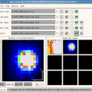
p3d is a general data-reduction tool that is intended to be used with data of fiber-fed integral field spectrographs (IFSs). This tool ... useful for people who have access to astronomical data of such an instrument. Data-reduction tasks, which are performed by p3d, convert raw data of CCD detectors into extracted spectra that can ...
| Author | Christer Sandin |
| Released | 2018-12-28 |
| Filesize | 45.60 MB |
| Downloads | 702 |
| OS | Windows XP, Windows Vista, Windows Vista x64, Windows 7, Windows 7 x64, Windows 8, Windows 8 x64, Windows 10, Windows 10 x64 |
| Installation | Instal And Uninstall |
| Keywords | field spectrograph, data reduction, astronomical data, reduction, reduce, spectrograph |
| Users' rating (26 rating) |
p3d Free Download - we do not host any p3d torrent files or links of p3d on rapidshare.com, depositfiles.com, megaupload.com etc. All p3d download links are direct p3d download from publisher site or their selected mirrors.
| 2.6.2 | Dec 28, 2018 | New Release | New functionality and bug fixes - The spectrum viewer now handles image (files) that contain a second image in the extension BSW_DATA; this second image could contain so-called laser offset, or beam-switched, spectra that are offset from the regular spectra. The user can select between the regular spectra, the [laser] offset spectra, the difference between the two, and a, so-called, laser normalized difference between the two using the new droplist widget on the Extra control panel or using the new menu entries in the "Image View" menu. Two additional widgets allow the offset BSW data to be multiplied with a factor before the offset spectra are subtracted from the nominal spectra; the default multiplication factor is 1.0. - Add File menu entries to look at the FITS file headers of the BSW_DATA and BSW_ERR extensions, when they are present. |
| 2.2.4.1 | Jun 21, 2013 | New Release | All tools that combine raw-data images: · Major bug fix - When I optimized the C routine of the image combination routine I introduced a serious bug. This bug is present in revisions 2753-2779 of p3d_cimcom.c, and is fixed with revision >=2780 C routines: · Optimization - Optimized the C routines p3d_cpixex.c and p3d_cmpd.c |
| 2.2.3 Rev279 | Jun 21, 2013 | New Release | All tools that combine raw-data images: · Major bug fix - When I optimized the C routine of the image combination routine I introduced a serious bug. This bug is present in revisions 2753-2779 of p3d_cimcom.c, and is fixed with revision >=2780 C routines: · Optimization - Optimized the C routines p3d_cpixex.c and p3d_cmpd.c |


