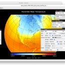
Panoply 5.4.1 freeware

Panoply is an utility that enable user to plot raster image. Depending on the data, it can draw global longitude-latitude images or pole-to-pole latitude-vertical images.Panoply is a cross-platform application which plots geo-gridded arrays from netCDF, HDF and GRIB datasets. ...

Author Robert B. Schmunk
Released 2024-06-01
Filesize 34.00 MB
Downloads 496
OS Windows XP, Windows Vista, Windows Vista x64, Windows 7, Windows 7 x64, Windows 8, Windows 8 x64, Windows 10, Windows 10 x64, Windows 11
Installation Instal And Uninstall
Keywords plot raster image, longitude image, pole-to-pole image, raster image, rasterize, raster
Users' rating
(20 rating)
PanoplyCADWindows XP, Windows Vista, Windows Vista x64, Windows 7, Windows 7 x64, Windows 8, Windows 8 x64, Windows 10, Windows 10 x64, Windows 11
Panoply - view time Freeware Download Notice

Panoply Free Download - we do not host any Panoply torrent files or links of Panoply on rapidshare.com, depositfiles.com, megaupload.com etc. All Panoply download links are direct Panoply download from publisher site or their selected mirrors.

Panoply freeware - The Latest User Reviews
Panoply freeware - The Latest Versions History
5.4.1 Jun 1, 2024 New Release
5.4.0 May 11, 2024 New Release
5.3.4 Mar 29, 2024 New Release

Most popular CAD freeware downloads

FilterPro Desktop

3.1.0.23446 freeware download

... as ability to adjust passive element tolerances and view response variations; scale passive component values; and view and export filter performance data to Excel. ... from the functionality of v3.1. Easily generate schematics, view frequency and time responses, and print professional design ...

Panoply for Mac

5.4.1 freeware download

... GRIB datasets. Panoply is designed to help you view and process the data included in netCDF, HDF, ... color contour plots of geo-referenced latitude-longitude, latitude-vertical, longitude-vertical, time-latitude or time-vertical arrays sliced from 2D or larger ...

TNTatlas

2024 B20240606 freeware download

TNTatlas is a powerful free geodata viewer that lets you publish and distribute your maps ... disaster relief, health and plant protection, or other time-critical management activities. TNTatlas, from MicroImages, Inc. is ...

TNTatlas for Mac OS X

2024 B20240508 freeware download

TNTatlas is a powerful free geodata viewer that lets you publish and distribute your maps ... disaster relief, health and plant protection, or other time-critical management activities. TNTatlas, from MicroImages, Inc. is ...

Sweet Home 3D

7.4 freeware download

... 2D plan are simultaneously reflected in a 3D view, and you can navigate in it either from an aerial view point, or from a virtual visitor view point. ...

SolidFace 3D CAD PTV

24.0.0.X freeware download

... and circles, endpoint, etc; 3D printing compatibility; Exploded view; Clash and collision test; Communication with other Windows ... Graphics screen can be divided up to 16 view windows, allowing the visualization of several project details; ...

VEGA ZZ

3.2.3.28 freeware download

... hardware anti-aliasing, material management, 3D backgrounds. Stereo view (shutter or anaglyphic glasses). 10 bit output for each color channel for a smoother view (230 = 1.073.741.824 vs. 224 = 16.777.216 colors). ...

Panoply

5.4.1 freeware download

... help you plot raster images. It lets you view photos created with NetCDF, HDF, GEMPACK, GRIB and ... as highly intuitive so rookies may need extra time to get used to working with it. ...

Prode Valves

1.08 freeware download

... Valves and Safety Valves Modules * Data viewing in both spreadsheet mode (with capability of full editing) form view and graph view. * Access to a control ...

Gephi for Mac OS X

0.10.1 freeware download

... as social networks can be filtered with the timeline component. · Import temporal graph with the GEXF ... Save/Load project files · Use the Data Table view to browse and edit data Modular: · ...