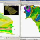
LanDTM 6.1 freeware

There is not any professional program on internet like this and you can get it without any effort. I think this could be a handicap because it's dificult to believe, but it's true; try it and you'll be surprised. It's not only a program to calculate a delaunay triangulation but you can input break-lines to get a real representation of the terrain. ...

Author Aplicaciones Topográficas S.L.
Released 2017-04-23
Filesize 58.80 MB
Downloads 662
OS Windows XP, Windows Vista, Windows Vista x64, Windows 7, Windows 7 x64, Windows 8, Windows 8 x64, Windows 10, Windows 10 x64
Installation Instal And Uninstall
Keywords Delaunay triangulation, Terrain Representation, CAD addon, Delaunay triangulation, Calculate, Terrain
Users' rating
(14 rating)
LanDTMCADWindows XP, Windows Vista, Windows Vista x64, Windows 7, Windows 7 x64, Windows 8, Windows 8 x64, Windows 10, Windows 10 x64
LanDTM - work Freeware Download Notice

LanDTM Free Download - we do not host any LanDTM torrent files or links of LanDTM on rapidshare.com, depositfiles.com, megaupload.com etc. All LanDTM download links are direct LanDTM download from publisher site or their selected mirrors.

LanDTM freeware - The Latest User Reviews
LanDTM freeware - The Latest Versions History
6.1 Apr 23, 2017 New Release
6.1.6 Feb 16, 2012 New Release · New installers of the program to 32 and 64 bits platforms.
· LanDTM on BricsCAD v12.
· LanDTM on Autocad 2012.
· Separator/discriminator of points.
· Compatibility with "gsf" grid files REDNAP of Geoid ondulation.
· Elevation modification of PPuntos.
· Importation/exportationn of Points to PPuntos.
· Compatibility between formats. Trimble M3, GPS Trimble, GSI of Stonex.
6.1.5 Oct 5, 2011 New Release · You can digitalize lines and points in Google Earth and export them to the CAD. It Works in BricsCAD v11.

Most popular CAD freeware downloads

Myrtle

1.9.0 freeware download

... from the text, attempt chapter review problems, or work on other inquiry, problem, and project based activities. Myrtle's graphics and reporting features allow students to ...

TNTatlas

2024 B20240606 freeware download

... plays a growing part in the way we work and live. Maps, drawings, photos and related materials ... existing electronic map and database materials for those working in natural disaster relief, health and plant protection, ...

GstarCAD MC

3.3.1 freeware download

... Find text, etc. enables you do real CAD work on the go and enjoy the best mobile ... able to save your masterpieces in the local workspace. • Drawings from E-mail, Cloud Service or Network ...

QFitsView

8.6 freeware download

... efficiently is particularly noteworthy, ensuring that users can work with high-resolution images without performance bottlenecks. One ... apply filters directly within the software, streamlining the workflow from data acquisition to interpretation. The integration of ...

TNTmips

20240404 freeware download

... complete Geographic Information System (GIS) that lets you work with virtually any type of geospatial data including imagery, terrain surfaces, and map data with associated ...

3D Home Design by Livecad

3.1 freeware download

... interface which is even more intuitive, an interior work wizard, materials manager, a smart project browser, and a catalogue with an even more complete range ...

TrueSpace

7.61 freeware download

... while point editing to make it easier to work on areas of your model; a heal vertices ... optimise triangulation or quadrifying polygons to ensure a workable mesh; new point edit selection tools to grow, ...

Graph Streaming

0.7.0.12 freeware download

... experiences with graph streaming, why not start our work based on these experiences? That’s what we are ... also trying to be compatible with the available work. This Gephi Graph Streaming release is using two ...

JMARS

3.1.5 freeware download

... focus on Mars, it has branched out to work with data for Earth and the Moon, for which separate versions now exist. In all its ...

5 freeware award

TNTatlas for Mac OS X

2024 B20240508 freeware download

... plays a growing part in the way we work and live. Maps, drawings, photos and related materials ... existing electronic map and database materials for those working in natural disaster relief, health and plant protection, ...