TNTmips 20240404 freeware

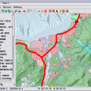
TNTmips is a geospatial image processing tool that allows you to analyze and modify GIS images. It is a professional application that can handle desktop cartography, electronic atlas preparation and spatial database management. ...

Author MicroImages, Inc.
Released 2024-04-04
Filesize 121.00 MB
Downloads 1731
OS Windows XP, Windows Vista, Windows Vista x64, Windows 7, Windows 7 x64, Windows 8, Windows 8 x64, Windows 10, Windows 10 x64, Windows 11
Installation Instal And Uninstall
Keywords GIS data analysis, analyze geodetic data, edit GIS dataset, GIS, dataset, editor, analysis
Users' rating
(121 rating)
TNTmipsCADWindows XP, Windows Vista, Windows Vista x64, Windows 7, Windows 7 x64, Windows 8, Windows 8 x64, Windows 10, Windows 10 x64, Windows 11
TNTmips - work Freeware Download Notice

TNTmips Free Download - we do not host any TNTmips torrent files or links of TNTmips on rapidshare.com, depositfiles.com, megaupload.com etc. All TNTmips download links are direct TNTmips download from publisher site or their selected mirrors.

TNTmips freeware - The Latest User Reviews
TNTmips freeware - The Latest Versions History
20240404 Apr 4, 2024 New Release
20240131 Jan 31, 2024 New Release
20240108 Jan 8, 2024 New Release

Most popular CAD freeware downloads

Myrtle

1.9.0 freeware download

... from the text, attempt chapter review problems, or work on other inquiry, problem, and project based activities. Myrtle's graphics and reporting features allow students to ...

TNTatlas

2024 B20240606 freeware download

... plays a growing part in the way we work and live. Maps, drawings, photos and related materials ... existing electronic map and database materials for those working in natural disaster relief, health and plant protection, ...

QFitsView

8.6 freeware download

... efficiently is particularly noteworthy, ensuring that users can work with high-resolution images without performance bottlenecks. One ... apply filters directly within the software, streamlining the workflow from data acquisition to interpretation. The integration of ...

3D Home Design by Livecad

3.1 freeware download

... interface which is even more intuitive, an interior work wizard, materials manager, a smart project browser, and a catalogue with an even more complete range ...

TNTmips

20240404 freeware download

... complete Geographic Information System (GIS) that lets you work with virtually any type of geospatial data including imagery, terrain surfaces, and map data with associated ...

TNTatlas for Mac OS X

2024 B20240508 freeware download

... plays a growing part in the way we work and live. Maps, drawings, photos and related materials ... existing electronic map and database materials for those working in natural disaster relief, health and plant protection, ...

OpenDCL Studio

9.1.5.2 freeware download

OpenDCL is a handy, easy-to-use and accessible insturment that is specially designed for AutoLISP programmers that want to replace AutoCAD's limited DCL. They can replace ...

Graph Streaming

0.7.0.12 freeware download

... experiences with graph streaming, why not start our work based on these experiences? That’s what we are ... also trying to be compatible with the available work. This Gephi Graph Streaming release is using two ...

TrueSpace

7.61 freeware download

... while point editing to make it easier to work on areas of your model; a heal vertices ... optimise triangulation or quadrifying polygons to ensure a workable mesh; new point edit selection tools to grow, ...

JMARS

3.1.5 freeware download

... focus on Mars, it has branched out to work with data for Earth and the Moon, for which separate versions now exist. In all its ...

5 freeware award