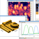
Gwyddion 2.66 freeware

... generally used for any other height field and image analysis, for instance for analysis of profilometry data (learn more about Gwyddion features). ...

Author David Necas and Petr Klapetek
Released 2024-05-26
Filesize 25.10 MB
Downloads 1748
OS Windows XP, Windows Vista, Windows Vista x64, Windows 7, Windows 7 x64, Windows 8, Windows 8 x64, Windows 10, Windows 10 x64, Windows 11
Installation Instal And Uninstall
Keywords data visualization, data analysis, height field analysis, analyze, visualize, visualizer
Users' rating
(43 rating)
GwyddionCADWindows XP, Windows Vista, Windows Vista x64, Windows 7, Windows 7 x64, Windows 8, Windows 8 x64, Windows 10, Windows 10 x64, Windows 11
Gwyddion - 3d image Freeware Download Notice

Gwyddion Free Download - we do not host any Gwyddion torrent files or links of Gwyddion on rapidshare.com, depositfiles.com, megaupload.com etc. All Gwyddion download links are direct Gwyddion download from publisher site or their selected mirrors.

Gwyddion freeware - The Latest User Reviews
Gwyddion freeware - The Latest Versions History
2.66 May 26, 2024 New Release
2.65 Jan 4, 2024 New Release
2.64 Oct 29, 2023 New Release

Most popular CAD freeware downloads

pCon.planner

8.9.0.100 freeware download

... Optimal handling of data - Realistic, on-demand product images with OSPRay - Sharing of pCon.planner panoramas directly ... Setting back-up folder for plans - OSPRay: Improved Image Quality - Rendering Animations with OSPRay - Exporting ...

TNTmips for Mac OS X

20240111 freeware download

... with virtually any type of geospatial data including imagery, terrain surfaces, and map data with associated database ... without importing. Overlay your geodata on Bing Maps imagery and maps or on geodata layers published on ...

MITO

2.0 freeware download

... makes it possible to fetch radiological information and images stored in a PACS according to the standard ... functionalities such as 2D-3D visualization (VR, SR, MIP), image segmentation and fusion, ROI. Moreover, MITO provides interaction ...

Elshayal Smart

23.02 freeware download

... save GPS route and View and Rectify Raster Images gif, jpg, bmp and Edit shape files, build ... network, find shortest path, print map, save map image, copy map image to clipboard, save project map, ...

VEGA ZZ

3.2.3.28 freeware download

... PDBQT multi-model formats. Snapshot, hardware and software image rendering with the capability to create images bigger than the monitor size. The software rendering ...

TNTmips

20240404 freeware download

... with virtually any type of geospatial data including imagery, terrain surfaces, and map data with associated database ... without importing. Overlay your geodata on Bing Maps imagery and maps or on geodata layers published on ...

Techne CAD/CAM

1.0.31.0 RC freeware download

... Flip or mirror designs Manually trace over bitmap image Grid layout with snap to line option ...

Techne CAD/CAM x64

1.0.31.0 RC freeware download

... Flip or mirror designs Manually trace over bitmap image Grid layout with snap to line option ...

M4 PERSONAL

7.0 freeware download

... advanced commercial package, includes basic 3D, parametrics, colour image integration and sheet metal design. The free download is available in English, German, French, Italian and ...

Gwyddion for Linux

2.66 freeware download

... generally used for any other height field and image analysis, for instance for analysis of profilometry data ... axes scale callibration · merging and immersion of images · tip modelling, blind estimation, dilation and erosion ...