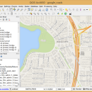
QGIS for Mac 3.36.1 freeware

QGIS supports vector, raster, and database formats and lets you browse and create map data on your computer.
QGIS supports many common spatial data formats (e.g. ESRI ShapeFile, geotiff). QGIS supports plugins to do things like display tracks from your GPS.
QGIS aims to be an easy to use GIS, providing common functions and features. The initial goal was to provide a GIS data viewer. ...

Author Gary Sherman
Released 2024-03-26
Filesize 1600.00 MB
Downloads 781
OS Mac OS X
Installation Instal And Uninstall
Keywords geographic information system, map creator, map viewer, GIS, geographic information, create, QGIS for Mac
Users' rating
(32 rating)
QGIS for MacCADMac OS X
QGIS for Mac - change Freeware Download Notice

QGIS for Mac Free Download - we do not host any QGIS for Mac torrent files or links of QGIS for Mac on rapidshare.com, depositfiles.com, megaupload.com etc. All QGIS for Mac download links are direct QGIS for Mac download from publisher site or their selected mirrors.

QGIS for Mac freeware - The Latest User Reviews
QGIS for Mac freeware - The Latest Versions History
3.36.1 Mar 26, 2024 New Release
3.36.2 Apr 25, 2024 New Release
3.36.1 Mar 26, 2024 New Release

Most popular CAD freeware downloads

Gephi

0.10.1 freeware download

... and quality. The Layout palette allows user to change layout settings while running, and therefore dramatically increase user feedback and experience. · Force-based algorithms · ...

GstarCAD MC

3.3.1 freeware download

... objects. • Precise Drawing available, e.g., user can change the number of the coordinates to move the points precisely. • Support 2D absolute coordinates, relative ...

SDMetrics

2.5 freeware download

... of the system design that have undergone much change, or evaluate alternative solutions to a design problem. Interoperability with UML tools: · SDMetrics is ...

FieldVIZ

r165 freeware download

FieldVIZ is meant to allow easy visual inspection of electro- and magnetostatic fields in 2D and 3D. ...

Weather Station Data Logger

5.6.0.0 freeware download

... following additional information: * 15-minute rate of change for temperature and dew point (indoor and outdoor). ... 3-hour altitude-corrected (aka sea level) pressure rate of change. The CSV-format log file is updated once ...

QGIS for Mac

3.36.1 freeware download

... raster formats supported by the GDAL library · Change vector symbology (single, graduated, unique value, and continuous) ... elevation models, aerial photography or landsat imagery · Change raster symbology (grayscale, pseudocolor and multiband RGB) · ...

QGIS for Linux

3.36.1 freeware download

... raster formats supported by the GDAL library · Change vector symbology (single, graduated, unique value, and continuous) ... elevation models, aerial photography or landsat imagery · Change raster symbology (grayscale, pseudocolor and multiband RGB) · ...

ShareCAD

2.0 freeware download

... any additional software; - zoom and rotate images, change display modes and use measuring tools; - print drawings; - create temporary links that will allow ...

MagicPlot Student

2.9.3 freeware download

... and copying * Automatic formula recalculation on data change * English ligatures support in labels Limited functionality - Free Personal and educational use only. ...

MagicPlot Student for Mac OS X

2.9.3 freeware download

... and copying * Automatic formula recalculation on data change * English ligatures support in labels Personal and educational use only. What is disabled ...