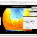
Panoply for Mac 5.4.3 freeware

... images or pole-to-pole latitude-vertical images.Panoply is a cross-platform application which plots geo-gridded arrays from netCDF, HDF and GRIB datasets. The utility can also combine two arrays and can project the analysis using more than 100 maps. ...

Author Robert B. Schmunk
Released 2024-06-24
Filesize 36.40 MB
Downloads 1133
OS Mac OS X
Installation Instal And Uninstall
Keywords plot raster image, longitude image, pole-to-pole image, raster image, rasterize, raster
Users' rating
(43 rating)
Panoply for MacCADMac OS X
Panoply for Mac - create application Freeware Download Notice

Panoply for Mac Free Download - we do not host any Panoply for Mac torrent files or links of Panoply for Mac on rapidshare.com, depositfiles.com, megaupload.com etc. All Panoply for Mac download links are direct Panoply for Mac download from publisher site or their selected mirrors.

Panoply for Mac freeware - The Latest User Reviews
Panoply for Mac freeware - The Latest Versions History
5.4.3 Jun 24, 2024 New Release
5.4.1 Jun 1, 2024 New Release
5.4.0 May 11, 2024 New Release

Most popular CAD freeware downloads

Panoply for Mac

5.4.3 freeware download

Panoply for Mac is a cross-platform application which plots geo-gridded arrays from netCDF, HDF and ... in order to generate geo-gridded plots. Since the application deploys on the Java Runtime, Panoply can be ...

Cytoscape for Mac OS X

3.10.0 freeware download

... expression profiles or GO annotations, generated by other applications or spreadsheet programs. Using this feature, you can ... set of custom annotation terms for your proteins, create a set of confidence values for your protein-protein ...

KiCad for Mac OS X

8.0.2 freeware download

... packed with many useful features for helping you create printed electronic circuits. KiCad allows you to upload NET files and view the selected footprint, ...

3D Home Design by Livecad

3.1 freeware download

... of split-levels, interior walls and balustrades - Fast application of textures and materials to all elements of ... wall and floor coverings from various angles - Create land areas, paths and terraces - Panoramic or ...

TNTmips

20240404 freeware download

... provides all the tools you need to view, create, edit, georeference, interpret, and publish any type of geospatial data. TNTmips provides professional geospatial tools in ...

Mobile Atlas Creator

2.2.1 freeware download

... Creator) is an open source (GPL) program which creates offline atlases for GPS handhelds and cell phone applications like TrekBuddy, AndNav and other Android and WindowsCE ...

QGIS for Mac

3.36.1 freeware download

QGIS is a professional GIS application that is built on top of and proud ... and database formats and lets you browse and create map data on your computer. QGIS supports ...

QGIS for Linux

3.36.1 freeware download

QGIS is a professional GIS application that is built on top of and proud ... and database formats and lets you browse and create map data on your computer. QGIS supports ...

3D Architecture by LiveCAD

2.1 freeware download

... of split-levels, interior walls and balustrades - Fast application of textures and materials to all elements of ... wall and floor coverings from various angles - Create land areas, paths and terraces - Panoramic or ...

TrueSpace

7.61 freeware download

The TrueSpace application was designed to be a fully-featured 3D authoring ... this release, making it easy for you to create your 3D objects and scenes. ยท The ...