Navigation:
- Freeware
- - Graphic Apps
- - CAD
- - Gwyddion
Gwyddion 2.66 freeware
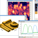
... a modular program for SPM (scanning probe microscopy) data visualization and analysis. Primarily it is intended for analysis of height fields obtained by scanning probe microscopy ... used for any other height field and image analysis, for instance for analysis of profilometry data (learn more about Gwyddion features). ...
| Author | David Necas and Petr Klapetek |
| Released | 2024-05-26 |
| Filesize | 25.10 MB |
| Downloads | 1748 |
| OS | Windows XP, Windows Vista, Windows Vista x64, Windows 7, Windows 7 x64, Windows 8, Windows 8 x64, Windows 10, Windows 10 x64, Windows 11 |
| Installation | Instal And Uninstall |
| Keywords | data visualization, data analysis, height field analysis, analyze, visualize, visualizer |
| Users' rating (43 rating) |
Gwyddion Free Download - we do not host any Gwyddion torrent files or links of Gwyddion on rapidshare.com, depositfiles.com, megaupload.com etc. All Gwyddion download links are direct Gwyddion download from publisher site or their selected mirrors.
| 2.66 | May 26, 2024 | New Release | |
| 2.65 | Jan 4, 2024 | New Release | |
| 2.64 | Oct 29, 2023 | New Release |


