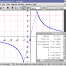
Engauge Digitizer for Windows 12.0 freeware

... converts an image file showing a graph or map, into numbers. The image file can come from ... with an image file containing a graph or map. The final result is digitized data that can be used by other tools such as Microsoft Excel. ...

Author Mark Mitchell
Released 2019-08-19
Filesize 10.60 MB
Downloads 931
OS Windows 2000, Windows 2003, Windows XP, Windows Vista, Windows Vista x64
Installation Instal And Uninstall
Keywords digitize image, image to number, process image, digitize, convert, digitizer
Users' rating
(34 rating)
Engauge Digitizer for WindowsCADWindows 2000, Windows 2003, Windows XP, Windows Vista, Windows Vista x64
Our rating 5 freeware award
Engauge Digitizer for Windows - data on map Freeware Download Notice

Engauge Digitizer for Windows Free Download - we do not host any Engauge Digitizer for Windows torrent files or links of Engauge Digitizer for Windows on rapidshare.com, depositfiles.com, megaupload.com etc. All Engauge Digitizer for Windows download links are direct Engauge Digitizer for Windows download from publisher site or their selected mirrors.

Engauge Digitizer for Windows freeware - The Latest User Reviews
Engauge Digitizer for Windows freeware - The Latest Versions History
12.0 Aug 19, 2019 New Release
10.4 Oct 11, 2017 New Release Show warning message when grid line maximum is exceed (#244)
CSV export files have double quotes on fields with internal commas (#243)
Status bar shows all of text for right-to-left languages (#240)
5.1 Dec 24, 2012 New Release Fix for broken point matching, and control of the x/theta axis label.

Most popular CAD freeware downloads

Panoply for Mac

5.4.3 freeware download

... plots geo-gridded arrays from netCDF, HDF and GRIB datasets. Panoply is designed to help you view and process the data included in netCDF, HDF, GRIB, and other types ...

TNTatlas

2024 B20240606 freeware download

... you publish and distribute your maps and geospatial data — from a single geodata file to complex map layouts prepared using TNTmips. TNTatlas lets you display ...

QGIS for Mac

3.36.1 freeware download

... Software (FOSS). QGIS supports vector, raster, and database formats and lets you browse and create map data on your computer. QGIS supports many common ...

TNTatlas for Mac OS X

2024 B20240508 freeware download

... you publish and distribute your maps and geospatial data — from a single geodata file to complex map layouts prepared using TNTmips. TNTatlas lets you display ...

QGIS for Linux

3.36.1 freeware download

... Software (FOSS). QGIS supports vector, raster, and database formats and lets you browse and create map data on your computer. QGIS supports many common ...

TNTmips

20240404 freeware download

... you work with virtually any type of geospatial data including imagery, terrain surfaces, and map data with associated database attributes. It provides all the tools you need ...

QGIS

3.36.1 freeware download

... Software (FOSS). QGIS supports vector, raster, and database formats and lets you browse and create map data on your computer. QGIS supports many common ...

MagicPlot Student for Linux

2.9.3 freeware download

... is a handy tool for scientific and engineer data processing, plotting and nonlinear fitting. MagicPlot is powerful ... export and copying * Automatic formula recalculation on data change * English ligatures support in labels ...

DX Central

2.20 freeware download

... different views of the sun · Doppler MDI map of the sun's far side · D-Region X-Ray absorption map from NOAA SWPC · Updates automatically every 10 ...

Thuban for Mac OS X

1.0.1-3 freeware download

Thuban is an interactive geographic data viewer (GIS viewer) which features methods to visualize, ... geographic information. Thuban is an Interactive Geographic Data Viewer with the following features: # Vector ...